Navajo Lake
1911
2005
Description:
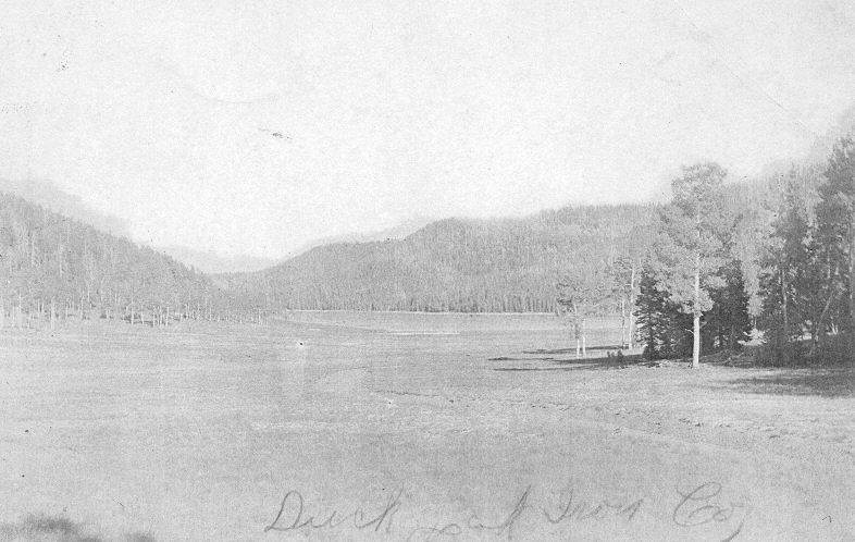
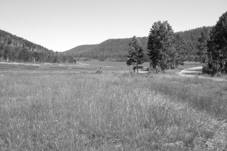
Plate 1087X. Navajo Lake 1911 – 2005 Viewed east-southeast to the western end of Navajo Lake. The road on the right has been realigned and paved, while a new left to right road has been added in the foreground. The meadow is mostly Kentucky bluegrass and native Stipa spp. In the distance, conifers, primarily spruce, Douglas fir, and white fir have increased, while aspen has declined. Aspen on the near right and left, however, regenerated 30 years ago when mule deer numbers were low, but not before or since due to ungulate browsing (Kay and Bartos 2000). Some spruce were recently killed by insects and disease.
Photo Information:
Original photograph taken on July 15, 1911; retake by Charles E. Kay on August 31, 2005 - - Photo No. 5936-31. Original photograph held by the Kanab Museum, Kanab, UT.
Vegetative Community:
Dry Meadow, Conifer, Aspen
Location:
South West: Section 2, Range 9 West, Township 38 South; UTM 339600 E, 4155300 N; elevation 9,100 ft.