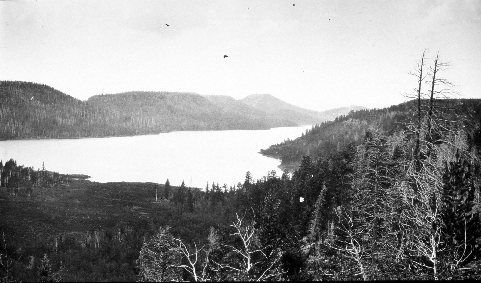
Navajo Lake
1909
2004
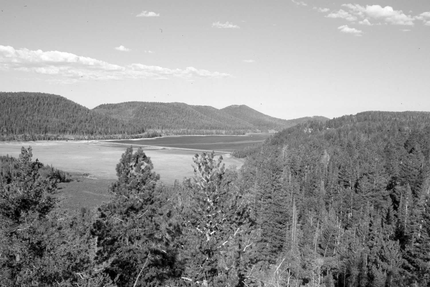
Description:
Plate 634X. Navajo Lake 1909 – 2004 Viewed southwest to Navajo Lake on the Dixie National Forest. The original camera station is now blocked by conifers, so the retake was made from the nearest open area. The 1909 image was made before the Forest Service built a dam across the eastern portion of Navajo Lake - - see Plate 608x. The lake was completely full in 1909. The treeless area at the north-eastern edge of the lake is a lava flow. Today, the former lakebed is sparsely vegetated with grasses and forbs. A new road right-of-way has been cleared on the south side of the lake - - see Plate 611x. Ponderosa pine, spruce, white fir, Douglas fir, and limber pine have all increased, while aspen has declined. Many spruce, however, have recently been killed by insects and disease. Note the fire-killed trees, including aspen, in the 1909 image.
Photo Information:
Original photograph taken by G.B. Richardson (No. 201) in 1909; retake by Charles E. Kay on August 11, 2004 - - Photo No. 5391-17A. Original photograph held in the U.S. Geological Survey Photographic Library, Denver, CO.
Vegetative Community:
Riparian, Conifer, Aspen
Location:
South West: Section 9, Range 8 West, Township 38 South; UTM 346200 E, 4154650 N; elevation 9,410 ft.