Navajo Lake
1927
2004
Description:
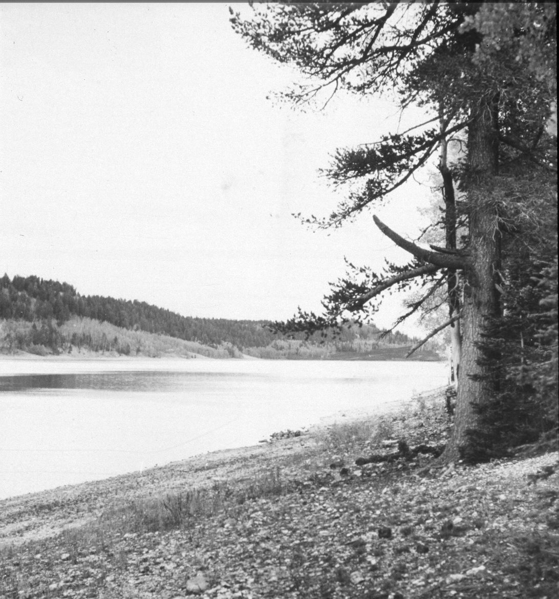
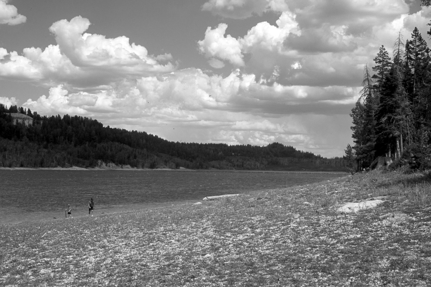
Plate 627X. Navajo Lake 1927 – 2004 Viewed northeast to Navajo Lake on the Dixie National Forest. The area in the foreground was inundated by high water during the early 1980’s - - see Plates 620x and 625x. The lake level has since fallen due to the extended drought. The original photograph was taken before the dam across the eastern portion of Navajo Lake was constructed - - the dam is visible in the retake. The rock cut on the left skyline is the overlook on Utah Highway 14 - - see Plates 605x and 606x. The hill on the right-center skyline is the photopoint for Plate 634x. In the distance, conifers have increased, while aspen has declined. Many spruce, however, have recently been killed by insects and disease.
Photo Information:
U.S. Forest Service photograph (352776) taken by Ben W. Schubert in September 1927; retake by Charles E. Kay on August 10, 2004 - - Photo No. 5389-8. Original photograph held by Southern Utah University Archives and Special Collections, Cedar City, UT
Vegetative Community:
Riparian, Conifer, Aspen
Location:
South West: Section 7, Range 8 West, Township 38 South; UTM 343200 E, 4153700 N; elevation 9,060 ft.