Navajo Lake
1934
2004
Description:
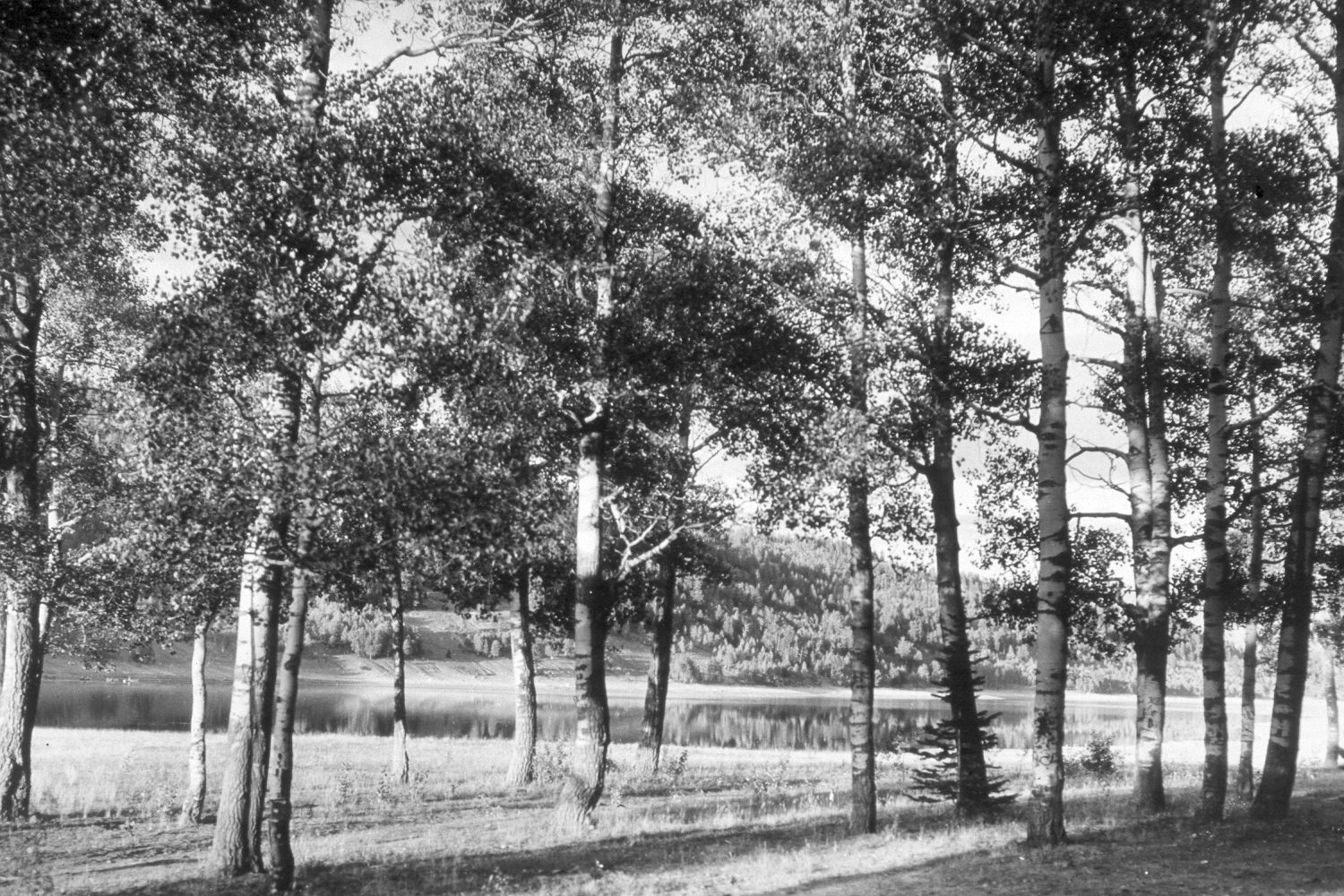
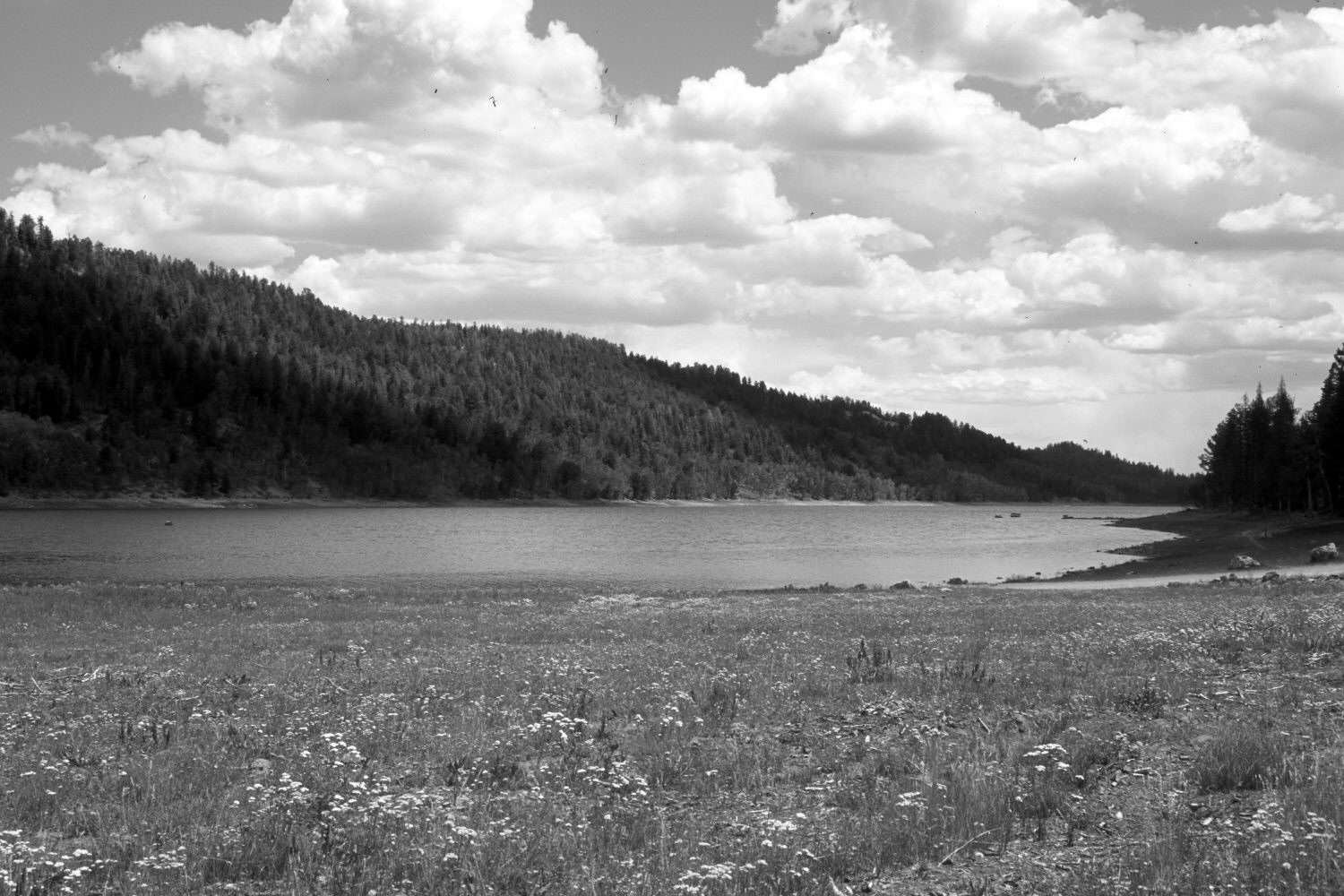
Plate 622X. Navajo Lake 1934 – 2004 Viewed northeast to Navajo Lake on the Dixie National Forest. The area in the foreground was once a major recreation area, but during the wet years of the early 1980’s, the lake level rose and flooded-out the site. The water level has since fallen due to the extended drought. The Forest Service has constructed a new campground above the high water mark - - that campground is called Navajo Lake and is the second developed public recreation area west of the dam. Aspen in the foreground was killed by the flooding. In the distance, ponderosa pine and Douglas fir, have increased, while aspen has declined.
Photo Information:
U.S. Forest Service photograph (295820) taken by J.E. Gurr in 1934; retake by Charles E. Kay on August 10, 2004 - - Photo No. 5386-16. Original photograph (2300-Dixie-1) held in the U.S. Forest Service Regional Office Photographic Collection housed at Weber State University, Ogden, UT.
Vegetative Community:
Riparian, Conifer, Aspen
Location:
South West: Section 7, Range 8 West, Township 38 South; UTM 341900 E, 4153900 N; elevation 9,060 ft.