Navajo Lake
1968
2004
Description:
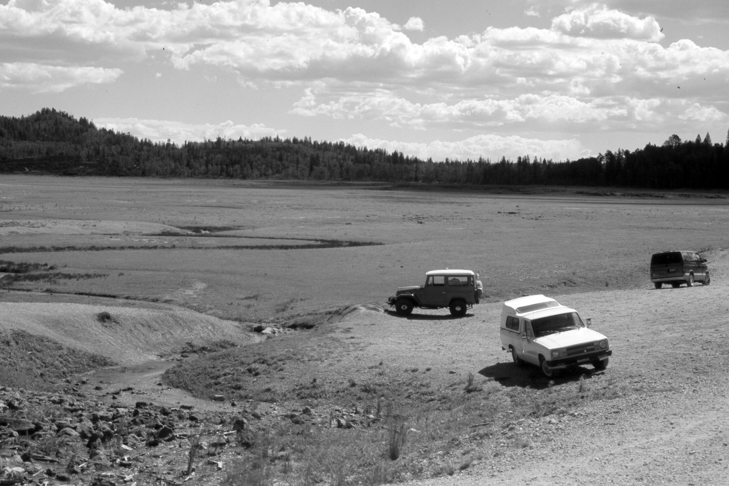
Plate 618X. Navajo Lake 1968 – 2004 Viewed northeast to Navajo Lake on the Dixie National Forest. In most years, the eastern portion of Navajo Lake no longer holds water due to the dam that was constructed in 1939 - - see Plate 607x. In wet years, however, water overtops the dam and fills the entire basin. 1968 must have been a very wet year because the lake was nearly fall. This part of the lake, though, was dry in 2004 due to the extended drought. In the distance ponderosa pine, spruce, and white fir have increased, while aspen has declined. Many spruce, however, have recently been killed by insects and disease. The hill on the left skyline is the photopoint for Plate 634x.
Photo Information:
U.S. Forest Service photograph taken by F. Jensen in August 1968; retake by Charles E. Kay on August 10, 2004 - - Photo No. 5386-6. Original photograph (2350.3-Dixie-A1493) held in the U.S. Forest Service Regional Office Photographic Collection housed at Weber State University, Ogden, UT.
Vegetative Community:
Riparian, Conifer, Aspen
Location:
South West: Section 8, Range 8 West, Township 38 South; UTM 344100 E, 4153650 N; elevation 9,030 ft.