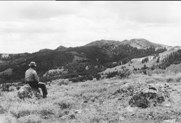
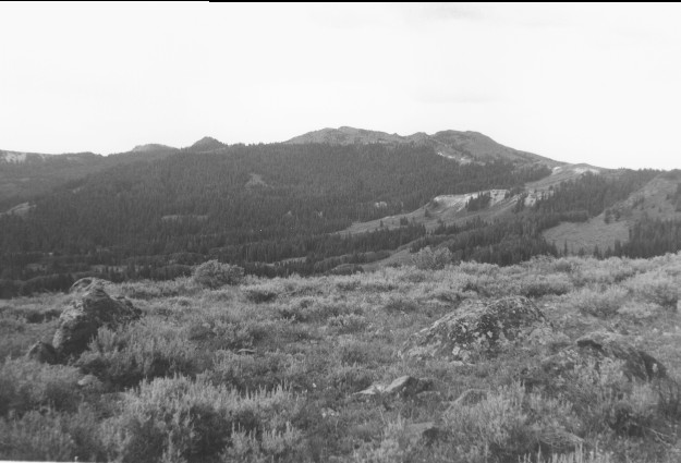
Mount Terrill
1938
1996
Description:
Plate 19. MOUNT TERRILL: 1938 - 1996 The vegetation in the foreground has not changed appreciably. Silver sage (Artemisia cana) is the predominate shrub; the more widely scattered and taller shrubs are currants (Ribes spp.). Conifers, primarily spruce (Picea sp.), have increase in height and numbers, as would be expected in the absence of fire. The Gooseberry-Sevenmile road is just below the hill in the foreground. This photo point is about 50 yards west of the one in Plate 18.
Photo Information:
1938 photo [#370025] taken by the Forest Service;; 1996 photo is Kay #4027-3 taken on Aug. 2. Forest Service photo [RG-95-G] is held by the National Archives, Washington, D.C.
Vegetative Community:
Sagebrush, Conifer
Location:
South Central: Upper Niotche Creek, Fishlake N.F., Richfield R.D., T24S, R2E., Sect. 2, UTM 4289300 N, 442750 E; elevation 10,550 ft.; view to south.