Mount Dutton
1905
2003
Description:
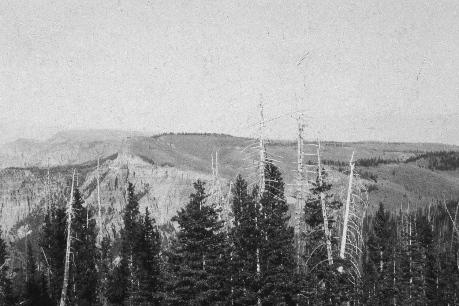
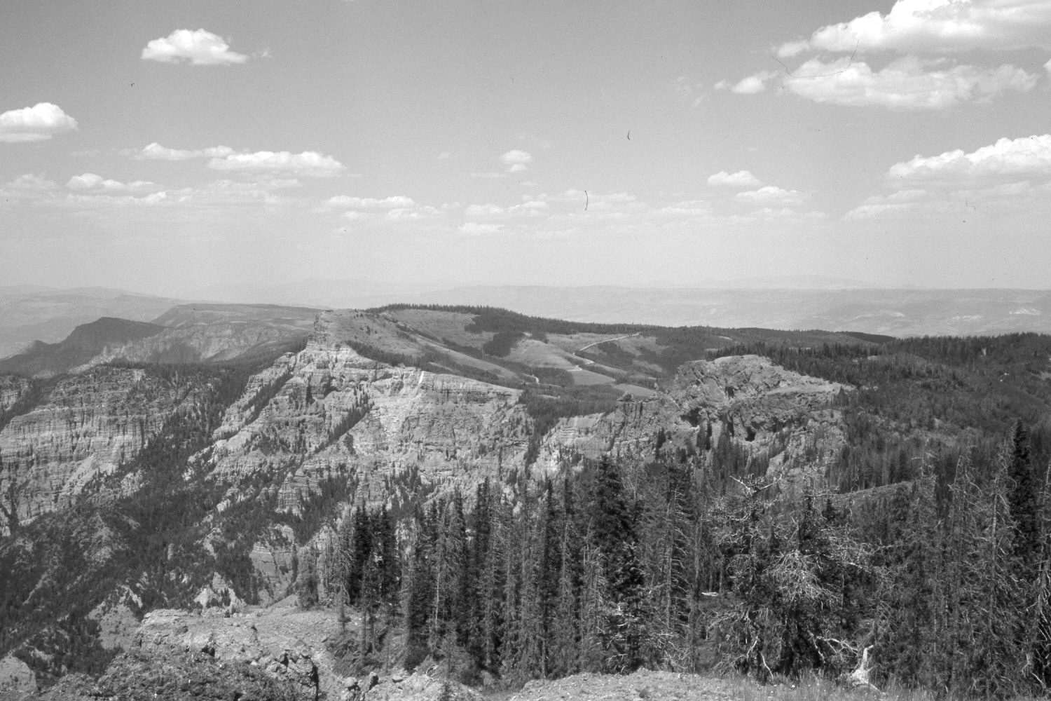
Plate 169X. Mount Dutton 1905 - 2003 Viewed northeast from the top of Mount Dutton. Lost Creek is on the left, while Pine and Forest Creeks are on the right. Conifers, primarily spruce, now block the original view, so the camera station for the retake was moved to the nearest open area, which is further to the west (left) and a little lower. A new road (USFS 125) now traverses upper Forest Creek (photo center), while logging roads have been built into upper Pine Creek (photo right-center). Aspen has increased in height, but otherwise declined as many stands have been invaded by conifers, which have increased despite clear-cut and selective logging. Many of the remaining older spruce have recently been killed by insects and disease. White fir, Douglas fir, and limber pine are also present.
Photo Information:
U.S. Forest Service photograph (58415) taken by R.V.R. Reynolds in 1905; retake by Charles E. Kay on July 11, 2003 - - Photo No. 5182-10. Original photograph held by Southern Utah University Archives and Special Collections, Cedar City, UT.
Vegetative Community:
Conifer, Aspen
Location:
South West: Section 15, Range 4 West, Township 30 South; UTM 393200E, 4208600N; elevation; 11,000 ft.