Moot Ridge
1958
2006
Description:
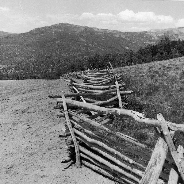
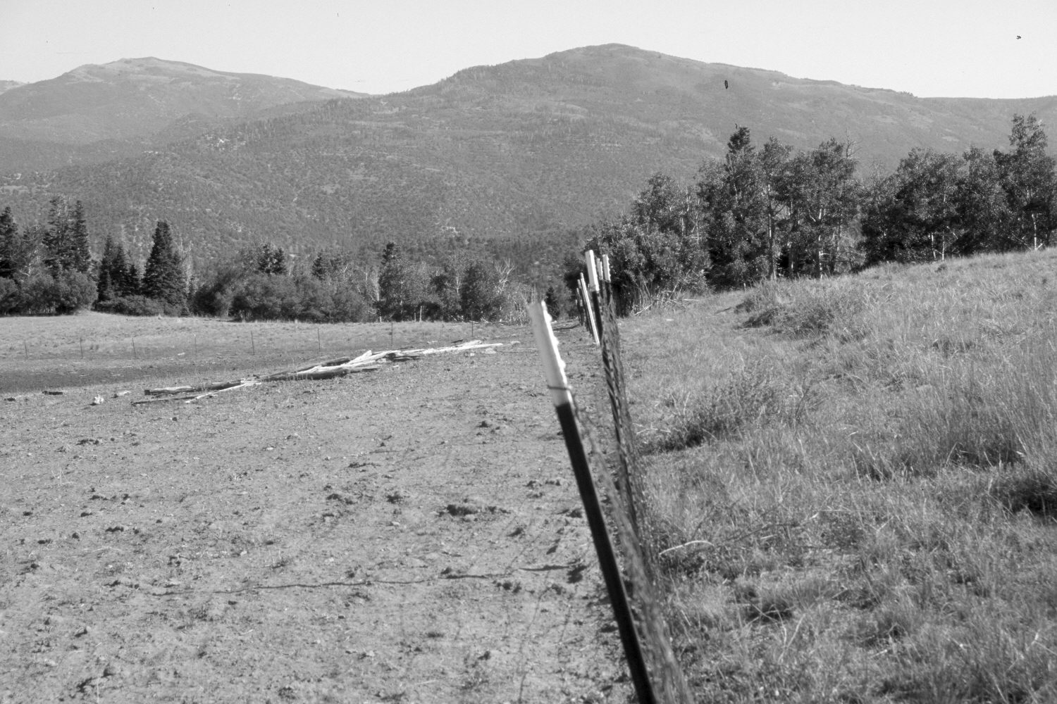
Plate 1358X. Moot Ridge 1958 – 2006 Viewed north to High Mountain (9,937 ft) from the ridge between Moot Hollow and Long Hollow east of Cedar City. The wooden-rail fence has been replaced with one of woven wire. The area to the left of the fence is a sheep bed-ground, is nothing but bare dirt, and is owned by Southern Utah University, while on the right is land administered by the Dixie National Forest. The area to the right of the fence, however, has recently been grazed by trespass sheep from the SUU allotment. At some point in the past, the Forest Service installed an ATV-type cattleguard where the fence meets the aspen in the distance. Soil then eroded off the ATV trail and filled-in the cattleguard, which allowed sheep to cross onto the National Forest. In addition to the sheep bed-ground, the SUU side of the fence is very heavily grazed. Oakbrush is highlined and shinney-leaf manzanita defoliated, something that is rarely seen, as that species is normally unpalatable. Some aspen has regenerated on the Forest Service side of the fence, but not on the SUU side due to excessive browsing by domestic sheep. The sheep on the SUU allotment are not herded but instead are allowed to free-range. The fence running to the left in the retake has not been maintained for many years allowing sheep to pass from one side to the other.
Photo Information:
U.S. Forest Service photograph (unnumbered) taken by Ross Butler in August 1958; retake by Charles E. Kay on July 18, 2006 - - Photo No. 5700-32. Original photograph held by Southern Utah University Archives and Special Collections, Cedar City, UT.
Vegetative Community:
Aspen
Location:
South West: Section 1, Range 9 West, Township 37 South; UTM 330400 E, 4165000 N; elevation 8,400 ft.