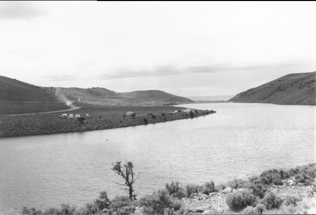
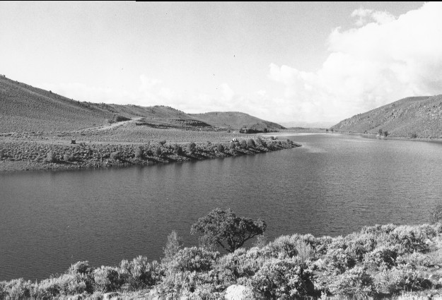
Mill Meadow Reservoir
1962
1999
Description:
Plate 72. MILL MEADOW RESERVOIR: 1962 - 1999 Scattered cottonwoods (Populus sp.) now occupy the shoreline in the 1999 photo and Utah Highway 25 has been realigned and paved, otherwise there is little apparent change.
Photo Information:
1962 photo taken by the U.S. Forest Service; 1999 photo is Kay #4459-2, taken on Aug. 11. Forest Service photo held by the Loa Ranger District, Loa, UT
Vegetative Community:
Riparian, Sagebrush
Location:
South Central: Fishlake National Forest, Loa Ranger District, T26S, R3E, Sect. 34, UTM 4261800 N, 451000 E; elevation 7,720 ft., viewed southwest.
January 2018