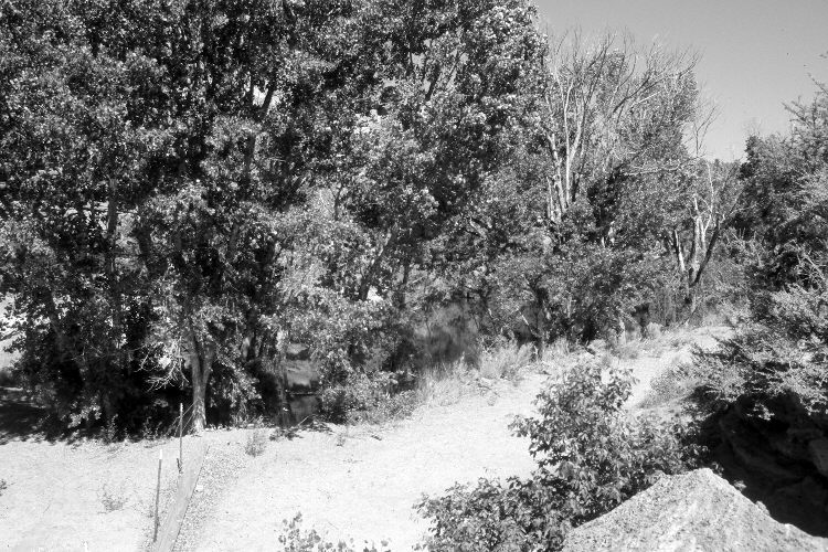
Middle Three Lakes
1872
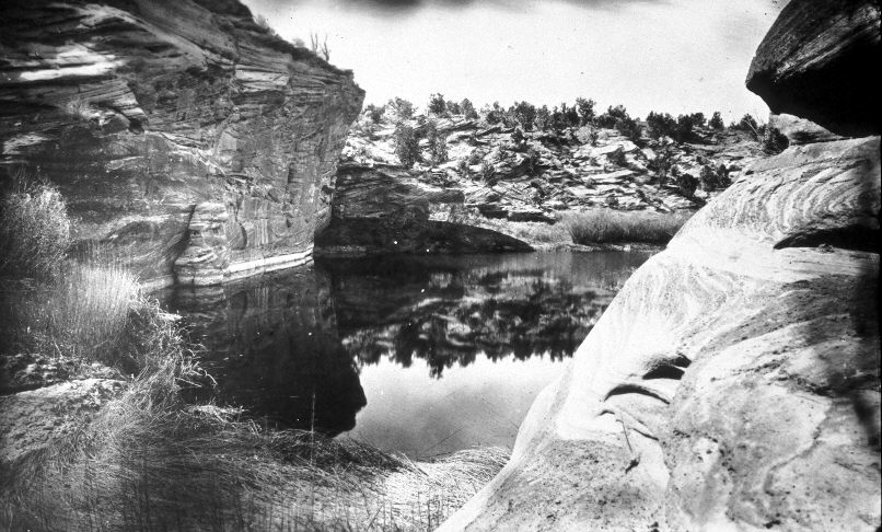
2005
Description:
Plate 866X. Middle Three Lakes 1872 – 2005 Viewed north to the middle of the Three Lakes above Kanab, Utah. The original camera station has been destroyed by highway construction. First, the road was built on the left of the dividing ridge - - that old road is still visible in the retake. Then U.S. Highway 89 was realigned just off the photograph to the right destroying the rock wall in the foreground. Cottonwoods have increased.
Photo Information:
Original photograph taken by John Hillers (No. 464) in 1872 (Fowler 1989); retake by Charles E. Kay on June 19, 2005 - - Photo No. 5455-12. Original photograph held by the National Archives, Washington D.C. and the U.S. Geological Survey Photographic Library, Denver, CO.
Vegetative Community:
Riparian
Location:
South West: Section 30, Range 6 West, Township 42 South; UTM 360900 E, 4110800 N; elevation 5,480 ft.