Meadow Creek Pavant Mountains
1939
2000
Description:
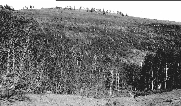
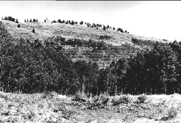
Plate 289. MEADOW CREEK PAVANT MOUNTAINS 1939-2000 This plate is similar to Plates 286-287 in that it is viewed east at the head of Meadow Creek in the Pavant Mountains. In the distance is White Pine Peak (10,215 ft) where limber pine and other conifers have increased. This area was contour-trenched, gully-plugged, and reseeded by the Forest Service to control erosion. Aspen has increased in height but has not regenerated due to excessive browsing. The dark-colored shrubs in the retake are snowberry and currant, while the tall forb in the foreground is lupine.
Photo Information:
U.S. Forest Service photo (unnumbered) by Albert Albertson in 1939; retake by Charles E. Kay on September 3, 2000 - - Photo No. 4714-14; Original photo (2500-A47) held by the Fillmore Ranger District, Fishlake National Forest, Fillmore, UT.
Vegetative Community:
Conifer, Aspen, Mountain Brush
Location:
South Central: Section 30, Range 3 W, Township 22 S; UTM 392500 E, 4302400 N; elevation 9,900 ft.