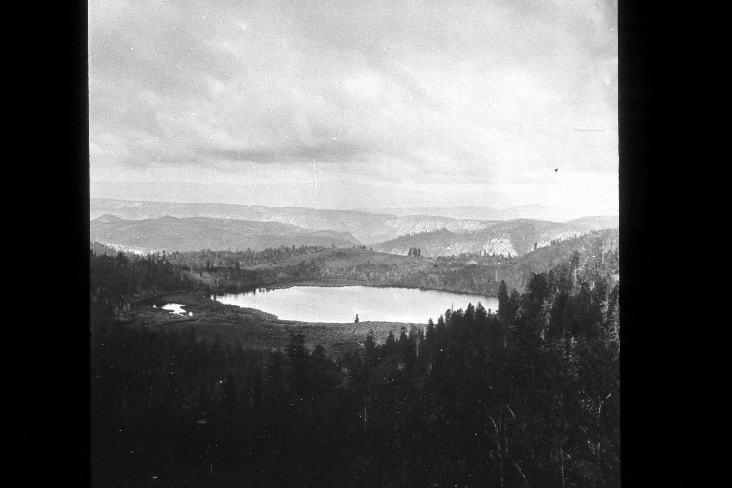
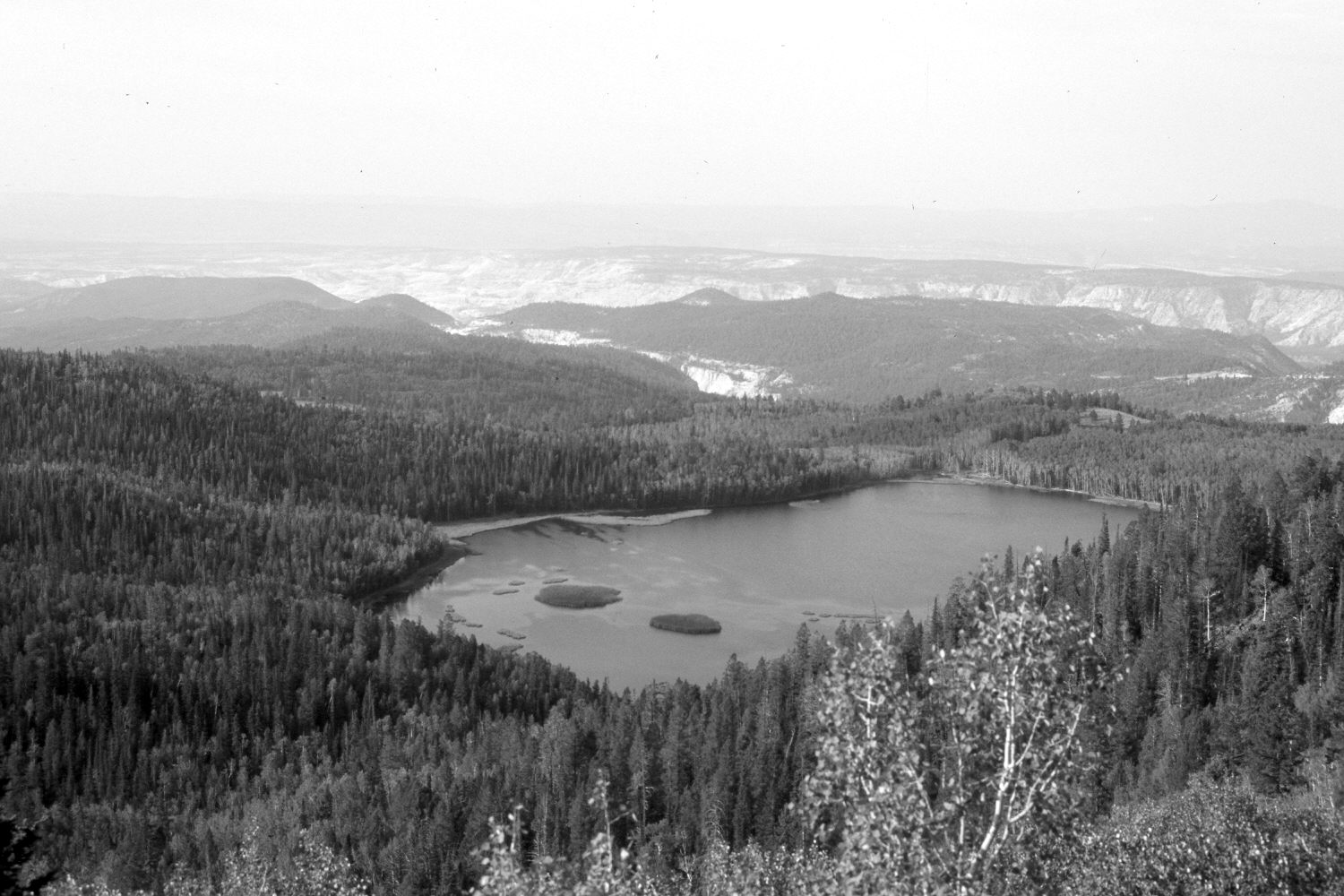
Mcgrath Lake
1872
2002
Description:
Plate 89X. McGrath Lake 1872-2002 Shown is McGrath Lake on the southern flank of Boulder Mountain. The exact photopoint could not be relocated as a dense forest now blocks the original view. Instead, the retake was made from the nearest open area, which is approximately 400 yards west and 300 feet higher than the original, thus altering the perspective. The cliffs beyond the lake are part of Sand Creek Canyon, while the more distant peak is Canaan Mountain. Most of the conifers in the 1872 photo were Douglas fir whose thick bark protected those trees from the frequent, low-intensity fires that once swept this area. Now, however, there is a dense ingrowth of Douglas fir, spruce, and subalpine fir (Abies lasiocarpa) even under most aspen stands. Aspen in the original also showed the effects of repeated burning, but most stands were successfully regenerating - - see Plate 90X. Today, though, there is little aspen regeneration due to excessive browsing by livestock and wild ungulates, primarily elk and mule deer. Aspen, however, has increased in height. The vegetation in the original photo had never been grazed by livestock, as this area was not settled until after this picture was taken, and aspen and willows in the original do not appear to have been browsed by either deer or elk. An irrigation dam has been built on the outlet, raising the lake level approximately 10 feet and flooding-out most of the riparian vegetation seen in the original, especially the willows on the eastside of the lake - - photo left. Visible in the retake is the Hell’s Backbone road. Viewed southwest.
Photo Information:
John Hillers photo 807 taken on June 9, 1872 (Fowler 1972:118); retake by Charles E. Kay on August 1, 2002 - - Photo No. 4996-22. Original photo (RG-057-PS) held by the National Archives, Washington D.C.
Vegetative Community:
Conifer, Aspen
Location:
South West: Section 22, Range 3 East, Township 32 South; UTM 450500 E, 4207000 N; elevation 10,100 ft.