Mcgath Lake
1872
1996
Description:
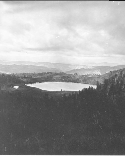
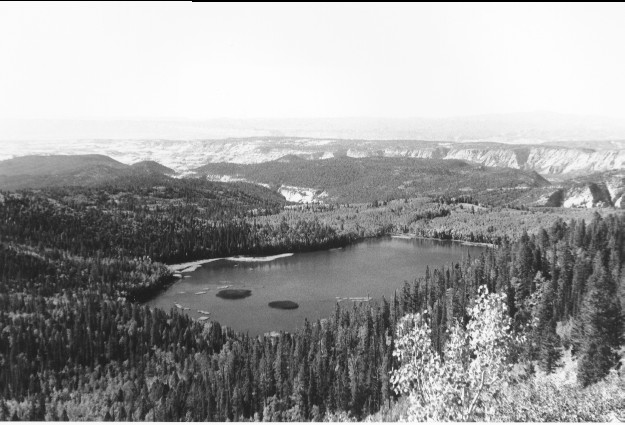
Plate 29. McGATH LAKE : 1872 - 1996 The exact photo point could not be relocated as a dense forest now blocks the 1872 view. The 1996 photo was taken from the nearest open area, which was approximately 400 yards west and 300 feet higher than the original, thus altering the perspective. The cliffs beyond the lake are part of Sand Creek Canyon, and the more distant peak is Canaan Mountain. Most of the conifers in the 1872 photo are Douglas-fir (Pseudotsuga menziesii), whose thick bark protects the tree from the frequent, low-intensity fires that once swept this area. In 1996, however, there is a dense growth of Douglas-fir, spruce (Picea sp), and subalpine fir (Abies lasiocarpa) regeneration, even under most of the aspen (Populus tremuloides) stands. Aspen in the 1872 photo show the effects of repeated burning, but most of the stands appeared to be successfully regenerating (see Plate 30). There is little aspen regeneration in recent years because of excessive browsing by livestock and wild ungulates, primarily mule deer. The vegetation in the 1872 photo had never been grazed by livestock because this area was not settled until after this photo was taken. Aspen and willow (Salix spp.) in the 1872 photo do not appear to have been browsed by either deer or elk. An irrigation dam on the outlet has raised the lake level approximately 10 feet and has flooded out most of the riparian vegetation seen in the 1872 photo, especially the willows on the left side of the lake.
Photo Information:
1872 photo [#807] taken by John Hillers; 1996 photo is Kay #4033-32 taken on Sept, 15. Hillers’ photo [RG-057-PS] held by the National Archives, Washington D.C.
Vegetative Community:
Conifer, Aspen, Riparian
Location:
South Central: On Boulder Mountain, T32S, R3E., Sect. 22, UTM 4207000 N, 450500 E; elevation 10,100 ft.; view to southwest.