Maverick Point
1957
1998
Description:
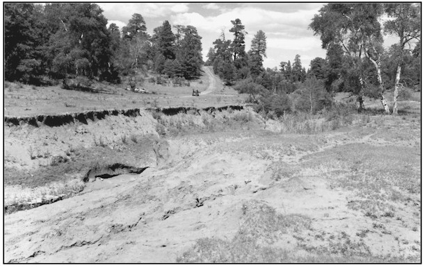
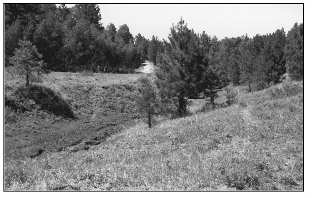
MAVERICK POINT This site is adjacent to the left fork of Vega Creek at Maverick Point on the Manti-LaSal National Forest. The view is northwest. Deep sandy loam. Average annual precipitation ranges from 20 to 24 inches. Plant density, vigor and ground cover have all increased at this site since 1957 and have combined to begin stabilization of both the upland and small riparian zone. The channel bottom is beginning to heal with the establishment of Baltic rush. Banks have evolved back to lesser anglesand are now being vegetated by smooth brome, and blue grasses. Rills and growing gullies visible in the foreground in 1957 have vegetated over and surface flows are diminishing. The area is not fully repaired but the improvement is obvious. Aspen trees at the right of the 1957 image have died, but the aspen clone at the left center has expanded since the original photograph.
Photo Information:
Photograph Number: Harper No. 1 Click here to view photograph Original: Date: 1957 (- A) Photographer: Kimball T. Harper Source: U.S. Forest Service, Price, Utah Retake: Date: July 29, 1998 (- B) Photographer: Earl Hindley Source: San Juan County
Vegetative Community:
Riparian
Location:
San Juan: NE1/4SW1/4 Section 8 T.34S., R.21E.