Maple Hollow
1942
1999
Description:
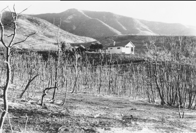
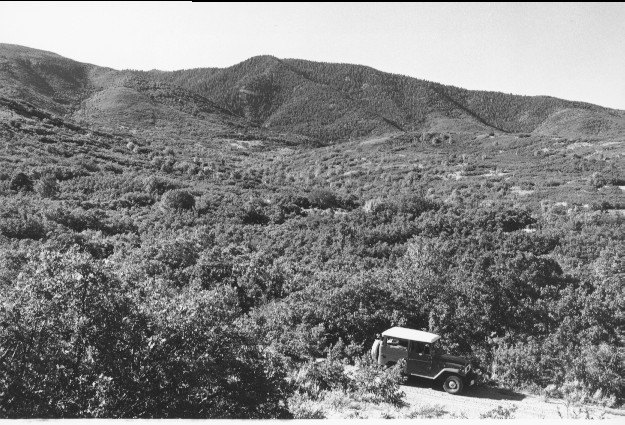
Plate 178 MAPLE HOLLOW: 1942 - 1999 The 1942 photo was taken shortly after the area was overrun by wildfire. The building in the 1942 photo was part of the facilities built by the Utah Division of Wildlife Resources to study mule deer food habits. This photo was taken from the approximate location of the vehicle in the 1999 photo; the 1942 photo point could not be used in 1999 because visibility was blocked by vegetation that had grown since the fire. Most of the oak brush (Quercus gambelii) and maple (Acer grandidentatum?) sprouted from existing roots following the fire, and were 15 to 30 feet tall by 1999. True mountain mahogany (Cercocarpus montanus?) and sagebrush (Aretmisia tridentata) grew from seed. The vegetation in 1999 shows little sign that a raging crown fire swept the area 50 years earlier.
Photo Information:
1942 photo #423090 taken on Sept. 23 by the Forest Service; 1999 photo taken by Kay #4513-32 on Sept. 11. Forest Service photo [C-439–Bx16-p.107] held by the Utah Historical Society, Reed W. Bailey Collection, Salt Lake City, UT
Vegetative Community:
Oakbrush, Sagebrush, Mountain Brush
Location:
South Central: Fishlake National Forest, Fillmore Ranger District; T24S, R4W, Sect. 10, UTM 4308425 N, 388250 E; elevation 6,000 ft., viewed to south-southeast.