Maple Hollow
1942
2000
Description:
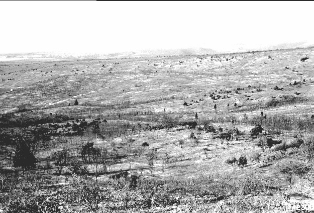
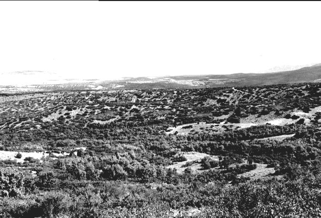
Plate 267. MAPLE HOLLOW 1942-2000 Plates 265-267 form a panorama across Maple Hollow from west to north and are similar to Plates 261-264 except that these were taken immediately after the wildfire in 1942. Note the extent of the crown fire and how it burned the Utah Division of Wildlife Resources’ mule deer research facility (Plates 177 and 178). The vegetation has regrown to such an extent, however, that it is difficult to imagine that this entire area was once swept by a raging inferno. Oakbrush is now 15-20 feet tall, while maple is 20-30 feet in height. True mountain mahogany and sagebrush have also recovered. Plate 267 is viewed north. The original camera station could only be approximated due to vegetation regrowth.
Photo Information:
U.S. Forest Service photo 423085 by S.S. Hutchings on September 17, 1942; retake by Charles E. Kay on August 6, 2000 - - Photo No. 4673-31A; Original photo held by Utah Historical Society, Reed W. Bailey Collection, Salt Lake City, UT.
Vegetative Community:
Oakbrush, Mountain Brush, Sagebrush
Location:
South Central: Section 10, Range 4 W, Township 22 S; UTM 388600 E, 4307300 N; elevation 6,500 ft.