Mammoth Creek
1938
2005
Description:
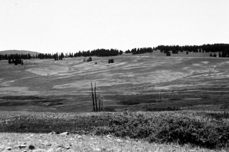
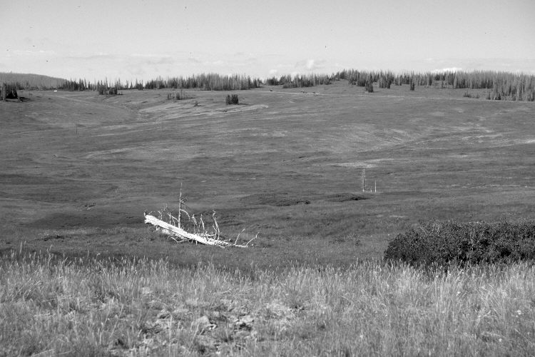
Plate 1123X. Mammoth Creek 1938 – 2005 Viewed south-southwest across the head of Mammoth Creek just below Mammoth Summit. Blowhard Mountain (10,657 ft.) is on the left skyline - - note the FAA radar dome in the retake. Despite yearly grazing by sheep, the area appears more vegetated today than in the past. The shrub on the lower right is a willow, as are the taller shrubs in the valley. Spruce appear largely unchanged except many of the mature trees were recently killed by insects and disease. The site was actively being grazed by sheep in 2005. The low shrubs in the distance are currants. Utah Highway 143 is visible in both photos. The vehicles parked near the roadway in the 2005 image are at the boundary of Cedar Breaks National Monument.
Photo Information:
U.S. Forest Service photograph (unnumbered) taken in 1938; retake by Charles E. Kay on September 4, 2005 - - Photo No. 5551-28. S Original photograph held by Southern Utah University Archives and Special Collections, Cedar City, UT.
Vegetative Community:
Dry Meadow, Conifer
Location:
South West: ection 13, Range 9 West, Township 36 South; UTM 338700 E, 4170700 N; elevation 10,590 ft.