Lower Yellow Creek
1921
2004
Description:
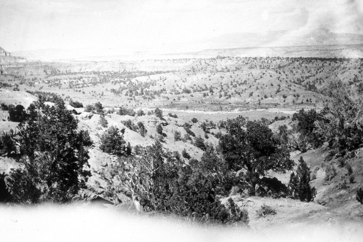
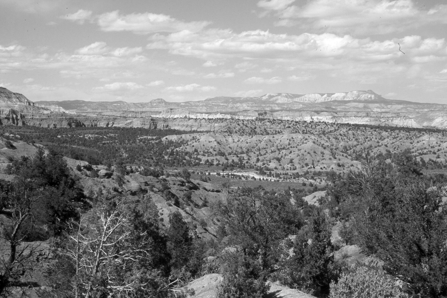
Plate 414X. Lower Yellow Creek 1921 – 2004 Plates 413x and 414x form a panorama. Plate 414x is viewed north-northeast. Table Cliff Plateau and Powell Point (10,188 ft.) are on the distant skyline. Shown is the lower portion of Yellow Creek before it enters the Paria River - - see Plate 413x. Pinyon and juniper have increased.
Photo Information:
Original photograph taken by R.C. Moore (No. 149) in 1921; retake by Charles E. Kay on May 11, 2004 - - Photo No. 5296-7. Original photograph held by the U.S. Geological Survey Photographic Library, Denver, CO.
Vegetative Community:
Pinyon, Juniper, Riparian
Location:
South West: Section 1, Range 3 West, Township 38 South; UTM 405500 E, 4154100 N; elevation 6,100 ft.
January 2018