Lower Salina Canyon
1923
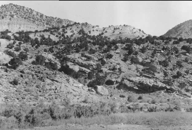
1996

Description:
Plate 45. LOWER SALINA CANYON: 1923 - 1996 The foreground and the hillside in the1996 photo point have been altered by construction of Interstate Highway I-70. The photo point is approximately 100 feet east of that in Plate 44. Little change is apparent in the pinyon (Pinus edulis) and juniper (Juniperus sp.) on these south-facing slopes since 1923, although there are some newly established plants such as those in front of the large boulder in the lower-center of the 1923 photo. A patch of tamarisk (Tamarix sp.) has also become established on the hillside above the road (right-center of the photo).
Photo Information:
1923 photo taken by Spieker #70; 1996 photo is Kay #4081-25, taken on Sept, 27. Spieker photo held by the U.S. Geological Survey Photographic Archives, Denver CO.
Vegetative Community:
Pinyon, Juniper, Sagebrush, Riparian
Location:
South Central: Fishlake N.F, Richfield R.D., T21S, R1E., Sect. 33, UTM 4309400 N, 431030 E; elevation 5,450 ft.; view to the north-east.