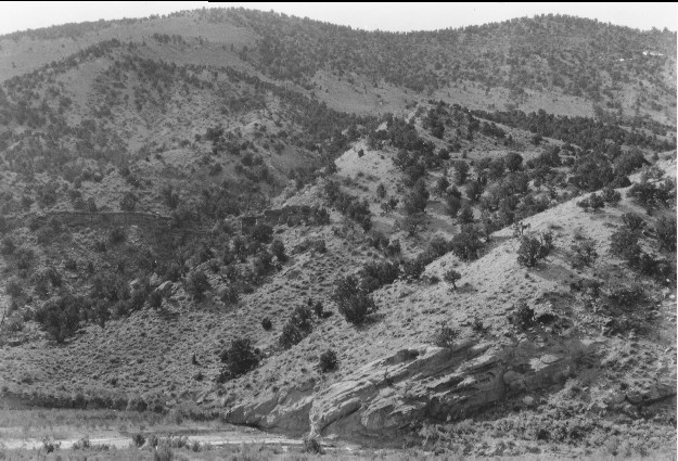
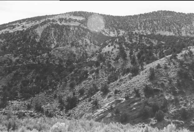
Lower Salina Canyon
1923
1996
Description:
Plate 44. LOWER SALINA CANYON: 1923 - 1996 The 1923 photo point has been altered by access road construction associated with construction of Interstate Highway I-70; the 1996 photo is from a slightly different location. The stream channel is more vegetated in 1996 than in 1923, but most of the shrubs/trees are tamarisk (Tamarix sp.) and Russian olive (Elaeagnus angustifolia), two exotic species that have increased throughout the west. Pinyon (Pinus edulis) and juniper (Juniperus sp.) have increased on these north-facing slopes, especially at the higher elevations where there is more moisture. Livestock trails are evident on the lower slopes in 1996, but the upper slopes appear largely ungrazed.
Photo Information:
1923 photo taken by Spieker #71; 1996 photo is Kay #4081-33, taken on Sept, 27. Spieker photo held by the U.S. Geological Survey Photographic Archives, Denver CO.
Vegetative Community:
Riparian, Juniper, Pinyon
Location:
South Central: Fishlake N.F, Richfield R.D., T21S, R1E., Sect. 34, UTM 4309400 N, 431000 E; elevation 5,450 ft.; view to the south.