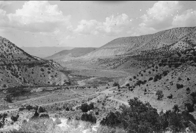
Lower Salina Canyon
1923
1996
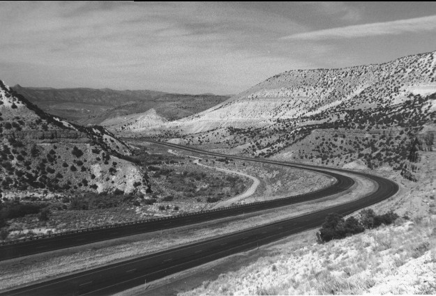
Description:
Plate 42. LOWER SALINA CANYON: 1923 - 1996 Fishlake N.F, Richfield R.D., T22S, R1E., Sect. 3, UTM 4309000 N, 432100 E; elevation 5,720 ft.; view to the west. The original photo point, the foreground, and much of the canyon bottom have been changed by construction of Interstate Highway I-70. This portion of Salina Creek is now stabilized and more vegetated than it was in 1923. There appears to be only a slight increase in pinyon (Pinus edulis) and juniper (Juniperus sp.) on the south-facing canyon walls, and a somewhat greater increase on the north-facing aspects.
Photo Information:
1923 photo taken by Spieker #77; 1996 photo is Kay #4077-33, taken on Sept, 27. Spieker photo held by the U.S. Geological Survey Photographic Archives, Denver CO.
Vegetative Community:
Riparian, Pinyon, Juniper, Sagebrush
Location:
South Central: Fishlake N.F, Richfield R.D., T22S, R1E., Sect. 3, UTM 4309000 N, 432100 E; elevation 5,720 ft.; view to the west.