Lower Niotche Creek
1923
2001
Description:
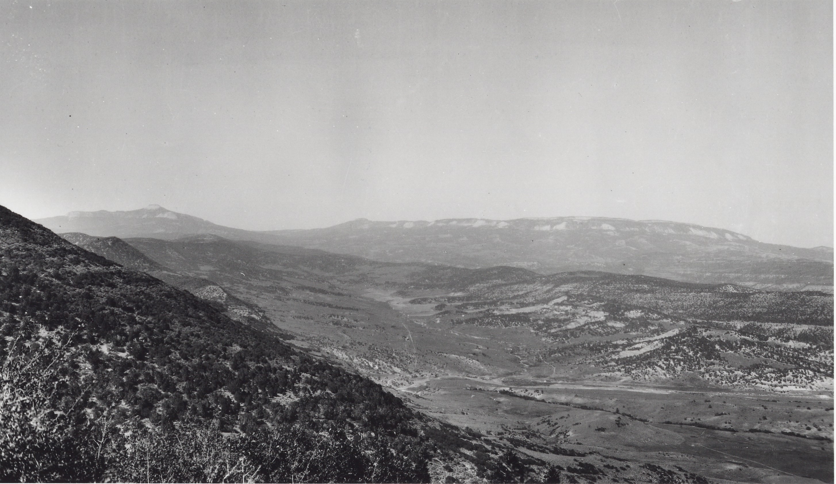
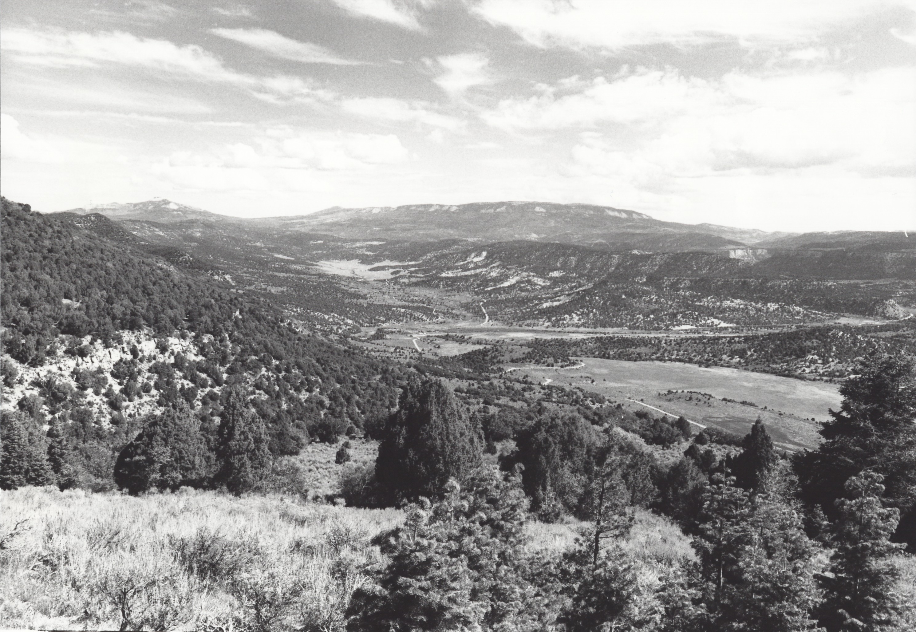
Plate 350. LOWER NIOTCHE CREEK 1923-2001 Plates 350 to 352 form a panorama over lower Niotche Creek. All three photographs were originally taken from one camera station but tall, dense vegetation now blocks those views, so the retakes were made from the nearest open areas. Moreover, Plate 350 had to be retaken from a slightly different camera station than Plates 351 and 352, again because the vegetation around the photopoint was so thick. Plate 350 is viewed north-northeast down the lower end of Niotche Creek. Also shown is Salina Creek and Taylor Flat. Musina Peak (10,984 ft - - a.k.a. Marys Nipple) is on the left skyline while White Mountain (10,800 ft) dominates the skyline in the center of the photo. Pinyon-juniper and other conifers have increased dramatically. Pinyon-juniper is in the process of replacing mountain brush species, such as oak brush, maple, serviceberry, and mountain mahogany, while white fir is beginning to invade both mountain brush and pinyon-juniper stands. The vegetation around the original photopoint is now so thick that foot access is difficult. Note the improved roads, including Interstate 70 along Salina Creek.
Photo Information:
Original photo taken in 1923; retake by Charles E. Kay on August 30, 2001 - - Photo No. 4889-4; Original photo (Spieker 87a) held by U.S. Geological Survey Photographic Library, Denver, CO.
Vegetative Community:
Pinyon, Juniper, Mountain Brush, Oakbrush, Conifer
Location:
South Central: Section 33, Range 3 E, Township 22 S; UTM 449200 E, 4301100 N; elevation 7,700 ft.