Lower Mill Creek
1925
1999
Description:
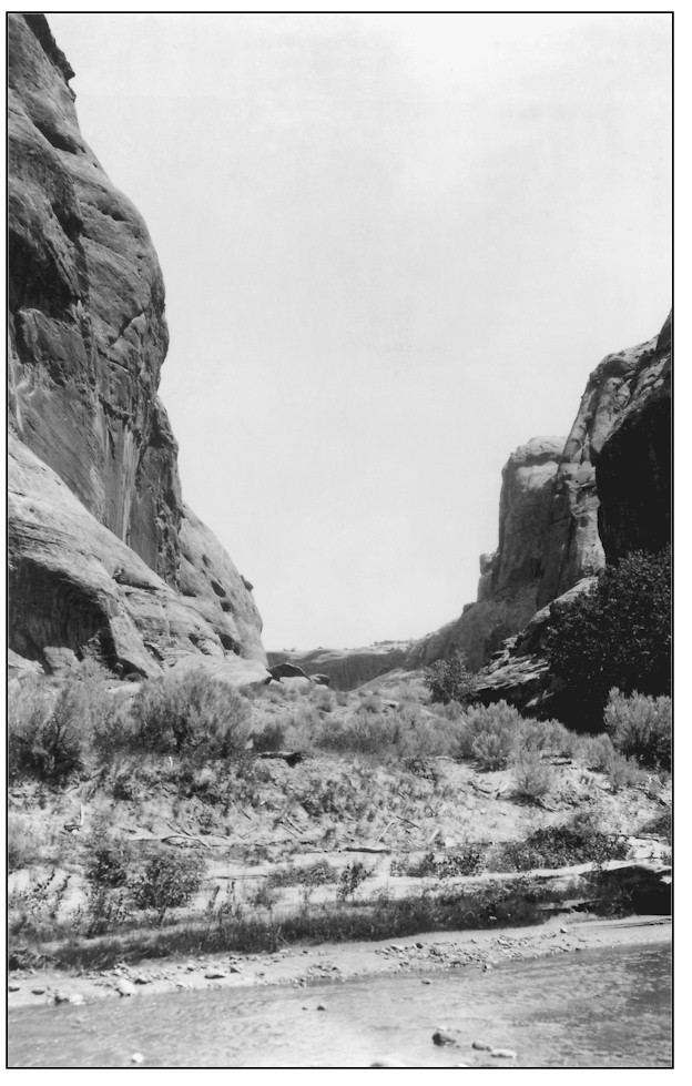
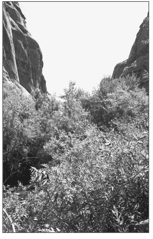
LOWER MILL CREEK 2 This westerly downstream view of Mill Creek was taken from just below the old Moab Power Dam. Although the site is in Grand County, a large portion of the Mill Creek's south fork watershed is located in San Juan County. The immediate foreground is public land administered by the Bureau of Land Management. Private lands start near the background hill. Baker's 1926 photograph shows an incised bedrock channel and an unvegetated point bar. A single Fremont cottonwood tree is visible along with a few willows near the dam overflow (foreground). The 1999 retake shows a healthy, properly functioning riparian zone with a wide variety of woody and herbaceous riparian plant species representing several age classes. Further outward expansion of the riparian zone at this point is impossible because of vertical bed rock banks. Note the same cottonwood tree in both photographs. Some other native riparian plants include Gooding willow, yellow willow, coyote willow, water birch, bulrush, spike rush, Baltic rush, horsetail, saltgrass, and white virgin's bower. Russian olive trees are also present and appear to be increasing. This area was grazed by cattle until 5 years ago when they were relocated. The area was closed to motorized vehicles at the same time but is now heavily impacted by pedestrian traffic.
Photo Information:
Photograph Number: Baker No.181 Original: Date: 1926 (- A) Photographer: A.A. Baker Source: U.S. Geological Survey, Denver, Colorado Retake: Date: June 28, 1999 (- B) Photographer: Earl Hindley Source: San Juan County
Vegetative Community:
Riparian
Location:
San Juan: NE1/4NW1/4 Section 8 T.26S., R.22E.