Lower Kane Creek
1927
1999
Description:
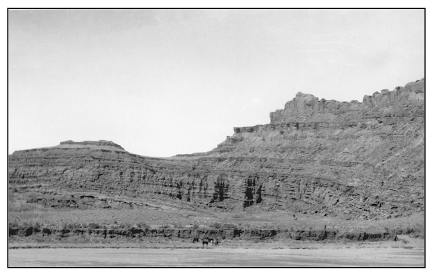
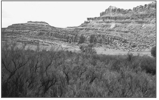
LOWER KANE CREEK Photograph Number: Goldman No. 334 Original: Date: April 14, 1927 (- A) Photographer: M.I. Goldman Source: U.S. Geological Survey, Denver, Colorado Retake: Date: May 13, 1999 (- B) Photographer: Earl Hindley Source: San Juan County General Description: This photopoint is found on the east side of Kane Creek about 150-200 feet south of the Grand/San Juan County boundary. The site is approximately 4.3 miles south of where Kane Creek drains into the Colorado River. The view is west across a state land block. Legal Description: NW1/4NE1/4 Section 33 T.26S., R.21E. COMPARISON The once wide active channel with vertical cutbanks is now covered with riparian vegetation. New floodplains have developed, the active channel has narrowed and the cutbanks have evolved back to lesser angles. Channel widths here range from 15 feet at the narrowest to 60 feet at the widest. Unfortunately, tamarisk dominates the vegetation community at this point, but there are a fair number of native riparian species present including Fremont cottonwood, coyote willow, and spikerush. Other than spikerush, there is a noticeable lack of herbaceous riparian species along the channel, but such species do appear in good numbers just a few hundred feet downstream in a more moist stream segment. This particular stream segment, although not properly functioning, is definitely in an upward trend.
Vegetative Community:
Riparian
Location:
San Juan