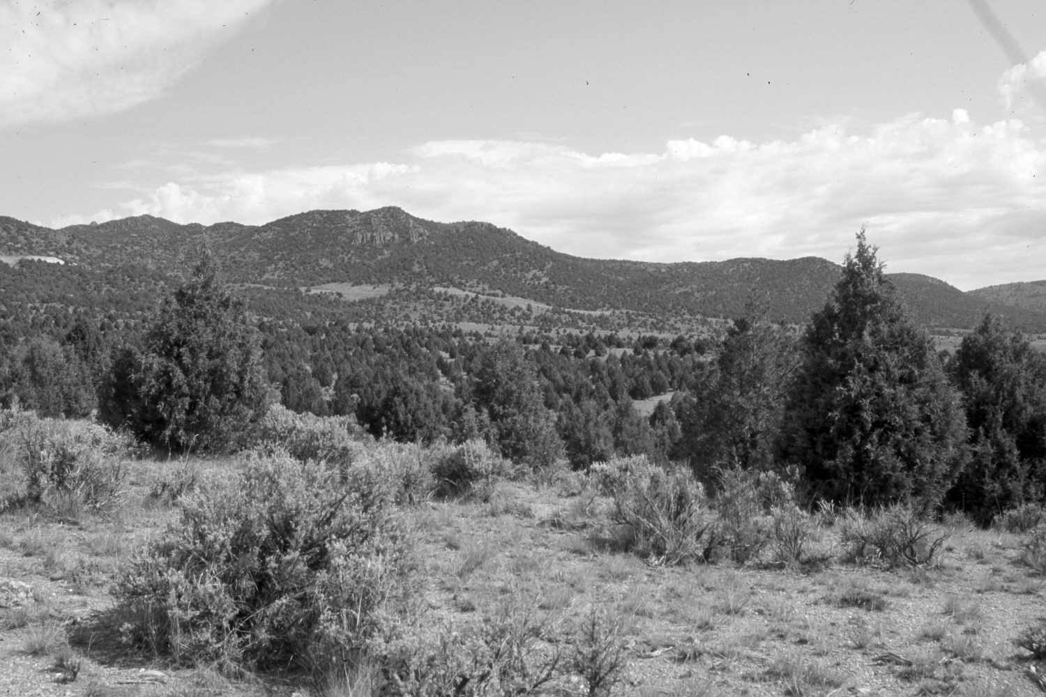
Lower Bear Valley
1924
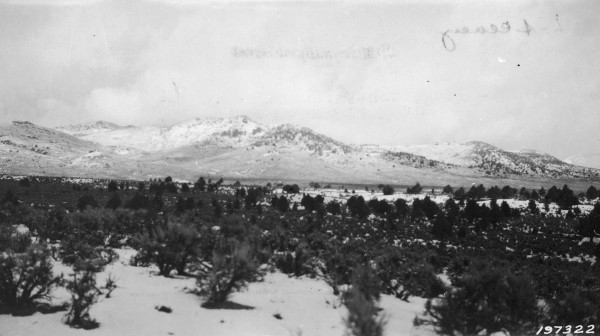
2006
Description:
Plate 1300X. Lower Bear Valley 1924 – 2006 Viewed northwest across Lower Bear Valley to Burnt Peak (8,784 ft). Pinyon and juniper now block the original photopoint, so the retake was made from the nearest open area. Utah Highway 20 is in the distance - - note the roadcuts. Pinyon, juniper, oakbrush, and mountain brush have all increased, as have wildland fuels.
Photo Information:
U.S. Forest Service photograph (197322) taken by Martin on November 11, 1924; retake by Charles E. Kay on June 27, 2006 - - Photo No. 5679-8. Original photograph (2310 – Dixie – 129) held in the U.S. Forest Service Regional Office Photographic Collection housed at Weber State University, Ogden, UT.
Vegetative Community:
Pinyon, Juniper, Mountain Brush
Location:
South West: Section 22, Range 6 West, Township 32 South; UTM 366450 E, 4207750 N; elevation 7,200 ft.