Looking Glass Rock From The So
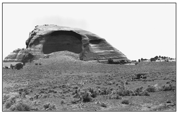
1927
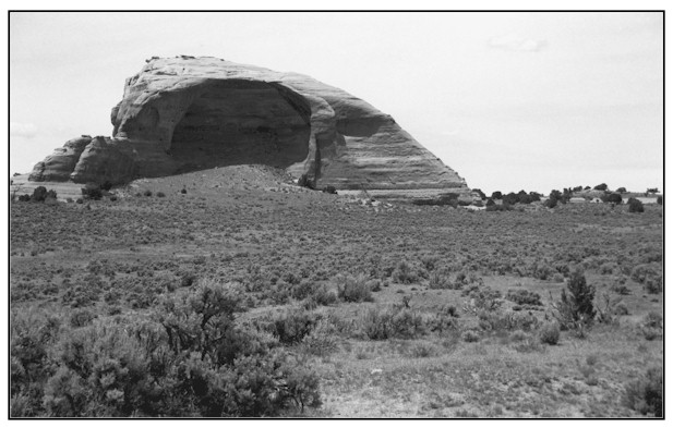
1999
Description:
LOOKING GLASS ROCK FROM THE SOUTH This northwest view of Looking Glass Rock was taken from private land looking across BLM and state lands. Both the original and the repeat photographs were taken with an 80mm lens, thus Looking Glass Rock appears much closer than it actually is. Deep Begay fine sandy loams are found on this site. These soils have effective root depths of more than 60 inches with moderately rapid permeability. Average annual precipitation at Looking Glass Rock ranges from 10 to 12 inches. Plant density and ground cover appear to have slightly increased since 1927. The most striking difference between the 1927 and 1999 images is the increased plant health and vigor in the 1999 scene. This site supports a diverse plant community of big sagebrush, fourwing saltbush, Mormon tea, Fremont barberry, Indian ricegrass, curlygrass, needle and thread grass, squirreltail, blue grama, sego lily, groundsel, globemallow, Hopi blanket flower, lupine, pinyon and juniper.
Photo Information:
Photograph Number: Lee No. 3049 Original: Date: 1927 (- A) Photographer: W.T. Lee Source: U.S. Geological Survey, Denver, Colorado Retake: Date: June 14, 1999 (- B) Photographer: Earl Hindley Source: San Juan County
Vegetative Community:
Sagebrush
Location:
San Juan: NW1/4NW1/4 Section 21 T.29S., R.23E.