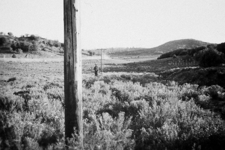
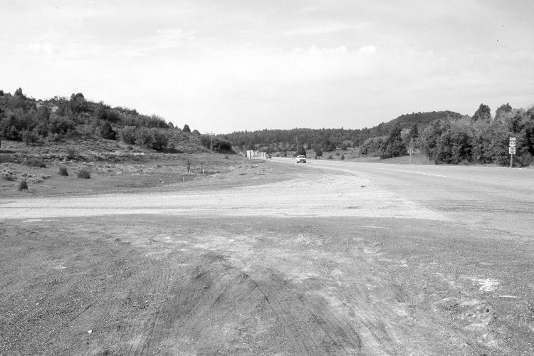
Long Valley Junction
1936
2005
Description:
Plate 882X. Long Valley Junction 1936 – 2005 Viewed south at Long Valley Junction; a.k.a. Gravel Springs Junction. In 1936, a series of snow courses were developed throughout southern Utah by what is today the Natural Resources Conservation Service (NRCS). When they were established, photographs were taken at each snow course. Although the snow course at Long Valley Junction is no longer used by NRCS, the photos remain. U.S. Highway 89 has been realigned, widened, and paved destroying the sagebrush flat seen in the initial image. In the distance, however, oakbrush, pinyon, juniper, and ponderosa pine have all increased. See Plates 895x and 896x for other views of this snow course.
Photo Information:
Original photograph (NRCS – 200) taken on September 8, 1936; retake by Charles E. Kay on June 21, 2005 - - Photo No. 5459-17. Original photograph held by the Snow Survey Supervisor, Natural Resources Conservation Service, Salt Lake City, UT.
Vegetative Community:
Oakbrush, Pinyon, Juniper, Conifer
Location:
South West: Section 22, Range 6 West, Township 38 South; UTM 366350 E, 4149900 N; elevation 7,454 ft.