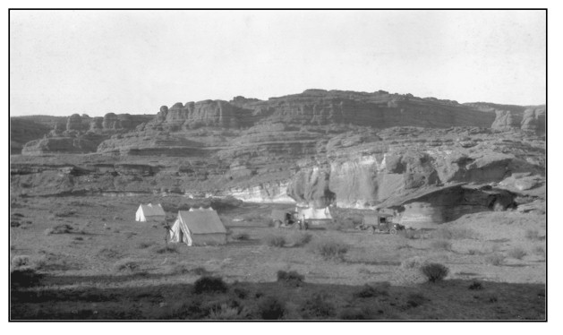
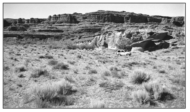
Lockhart Canyon
1927
1999
Description:
LOCKHART CANYON This site, an old USGS camp in Lockhart Canyon, is approximately 1.25 miles downstream from where the Lockhart Basin road crosses Lockhart Draw. The view is south across public land administered by the Bureau of Land Management. Soils at this valley bottom site are a Trail series. They are very deep, somewhat excessively drained, and rapidly permeable. They have been formed in alluvium derived mostly from sandstone. This soil has a very low available water capacity. Average annual precipitation ranges from 7 to 9 inches. Shrubs, such as sand sagebrush, fourwing saltbush, greasewood, snakeweed, and Mormon tea have increased. Grass species such as sand dropseed, Indian ricegrass, have also increased. The result is a much improved ground cover situation. Cheatgrass and Russian thistle also occur on this site in 1999. A small riparian zone has developed along the drainage area since 1927. The only riparian or moisture loving plants that occur here are tamarisk and saltgrass. Heavy cattle use occurred in this area just prior to the 1999 photograph. Livestock are drawn into the area by nearby springs and seeps.
Photo Information:
Photograph Number: Baker No. 295 Original: Date: 1927 (- A) Photographer: A.A. Baker Source: U.S. Geological Survey, Denver, Colorado Retake: Date: July 1, 1999 (- B) Photographer: Earl Hindley Source: San Juan County
Vegetative Community:
Salt Desert Shrub
Location:
San Juan: NE1/4NW1/4 Section 26 T.28S., R.20E.