Lion Rock
1872
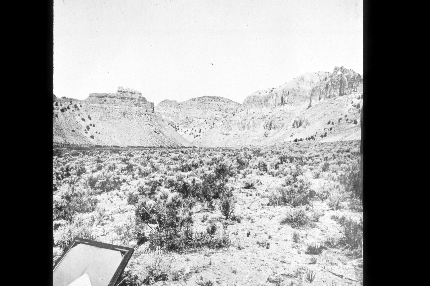
2003
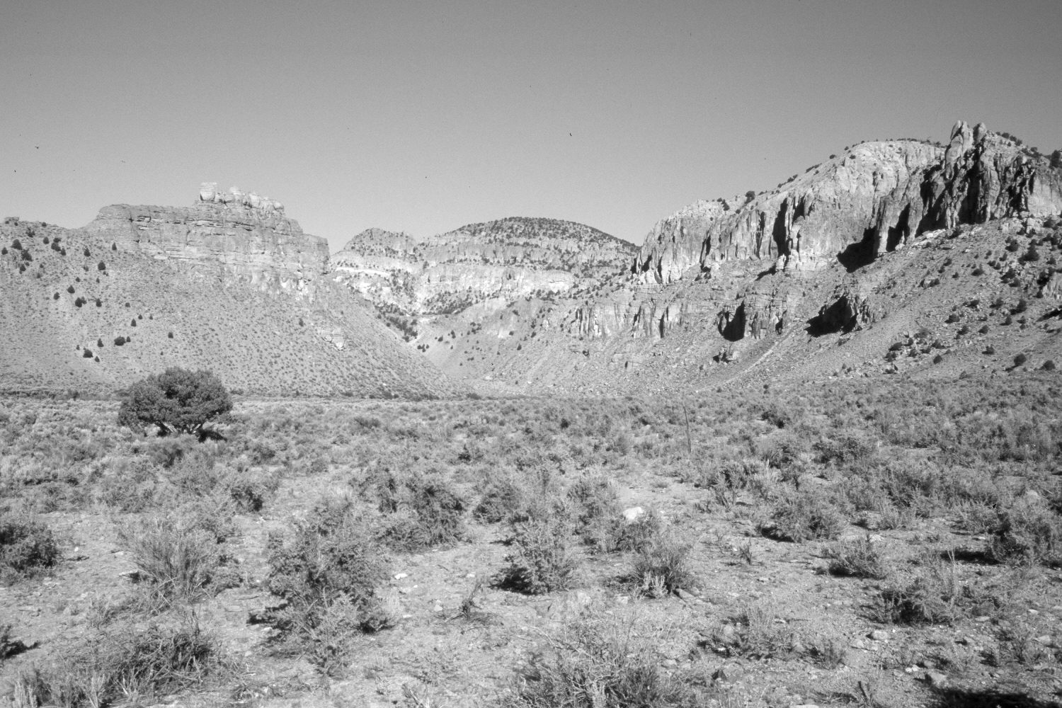
Description:
Plate 389X. Lion Rock East Fork of the Sevier River 1872 - 2003 Viewed west-northwest down the East Fork of the Sevier River to Lion Rock (photo left center) at the upper end of Kingston Canyon. The camera station is just below Utah Highway 62. The land in the foreground was recently aquired by the Utah Division of Wildlife Resources (DWR). Today, the foreground is mostly greasewood (Sarcobatus vermiculatus) with some Wyoming big sage (Artemisia tridentata wyomingensis), and looks much the same as it did in 1872. Pinyon and juniper appear largely unchanged on the dry, rocky hillsides. The woody riparian vegetation along the East Fork at the base of Lion Rock may have declined. The area was very heavily grazed by cattle and horses for many years before being purchased by the DWR. The low-growing grass is mostly blue gramma (Bouteloua gracilis). Some green rabbitbrush is also present. This view is similar to Plate 390x, except it was taken with a wide-angle lens. The object in the lower left corner of the original image is a wooden film holder and glass plate used in the 1872 camera.
Photo Information:
U.S. Geological Survey Photograph taken by John Hillers (No. 674) in 1872; retake by Charles E. Kay on August 31, 2003 - - Photo No. 5277-19. Original photograph held by the U.S. Geological Survey Photographic Library, Denver, CO.
Vegetative Community:
Sagebrush, Juniper, Riparian
Location:
South West: Section 16, Range 2½ West, Township 30 South; UTM 402200E, 4227800 N; elevation 6,200 ft.