Left Fork Of Blubber Creek
1950
2003
Description:
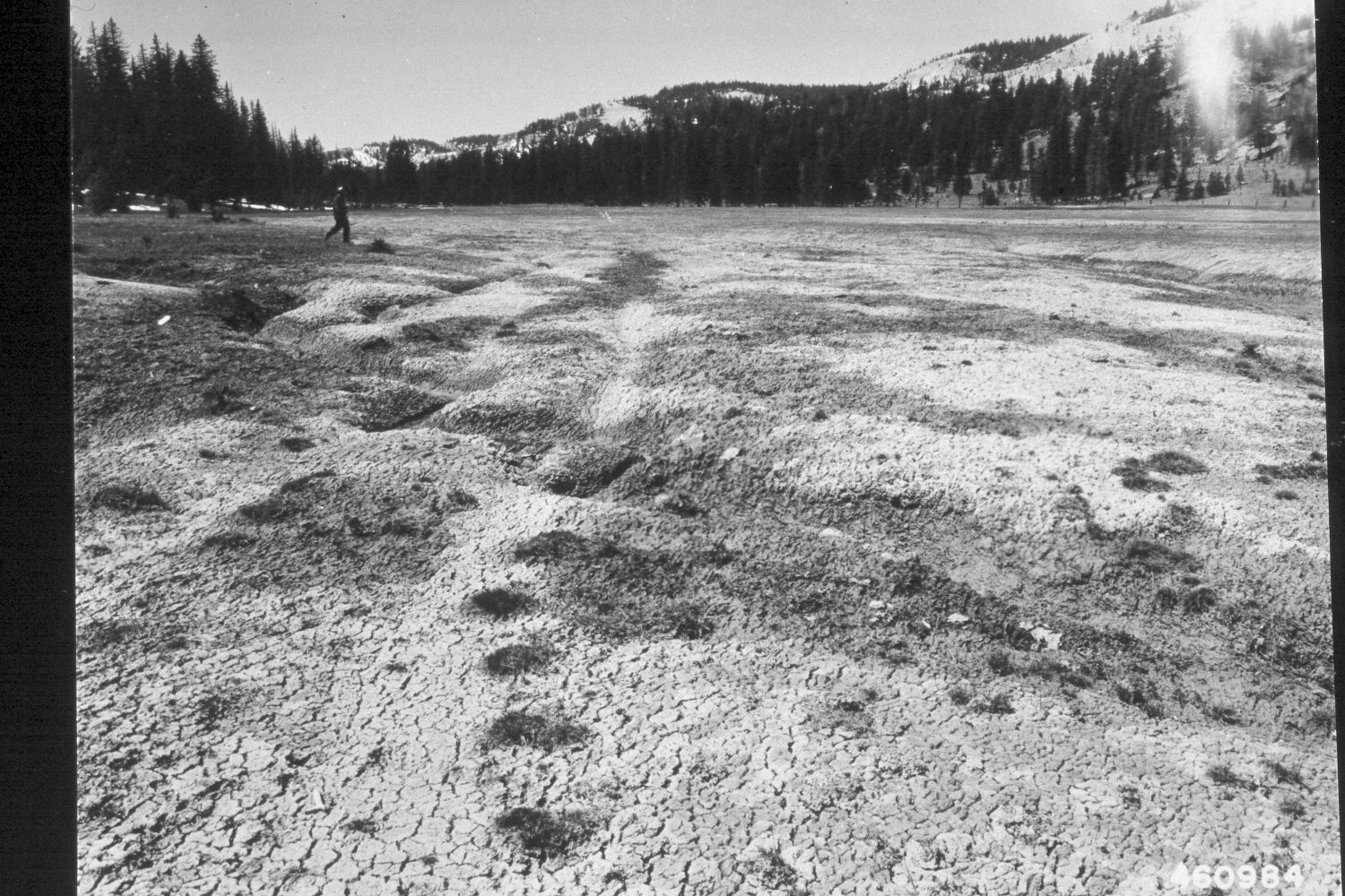
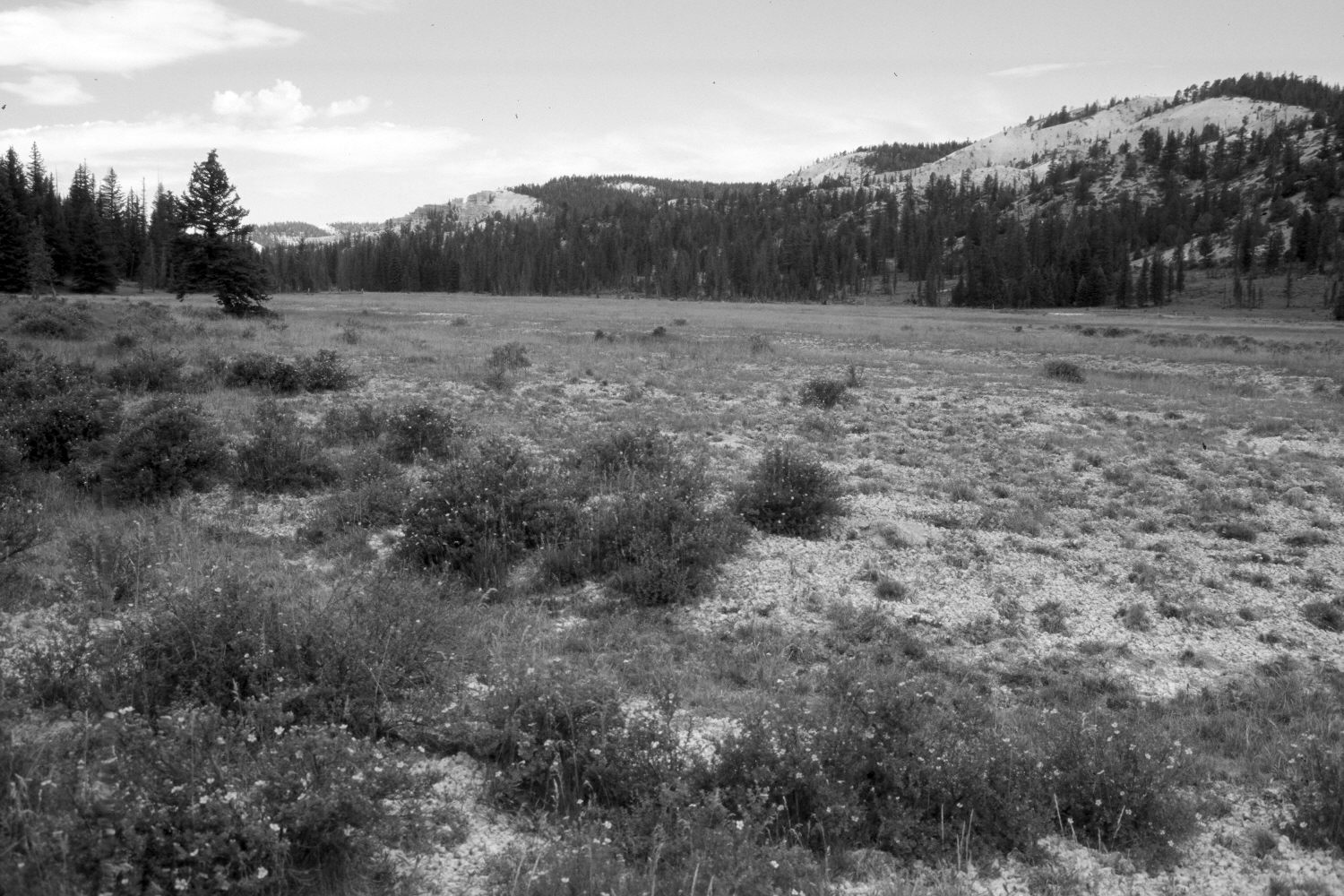
Plate 286X. Left Fork of Bubber Creek 1950 - 2003 Viewed southwest up the Left Fork of Blubber Creek on the Paunsangunt Plateau. Note the new allotment fence at the head of the meadow. Cattle were present above the fence when this camera station was revisited, but the foreground had not been grazed by livestock in 2003. Drier areas within the meadow have been reseeded with Kentucky bluegrass and intermediate wheatgrass. The shrubs in the foreground are mostly shrubby cinquefoil, while willows have increased (left-center photo edge). Most of the larger trees on the far hillsides have been logged, as have those on the left edge of the meadow. Nevertheless, conifers, primarily spruce, have increased. Native sedges and rushes dominate the wetter parts of the meadow, large portions of which are subirrigated.
Photo Information:
U.S. Forest Service photograph (460984) taken on April 24, 1950; retake by Charles E. Kay on August 7, 2003 - - Photo No. 5225-24. Original photograph held by the Utah Historical Society, Reed W. Bailey Collection (Box 11), Salt Lake City, UT.
Vegetative Community:
Dry Meadow, Riparian, Conifer
Location:
South West: Section 36, Range 4½ West, Township 37 South; UTM 386500E, 4156450 N; elevation 7,950 ft.