Lake Creek - Rattlesnake Creek
1966
2006
Description:
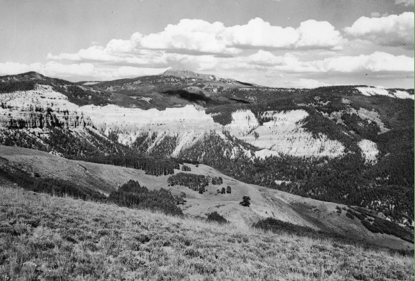
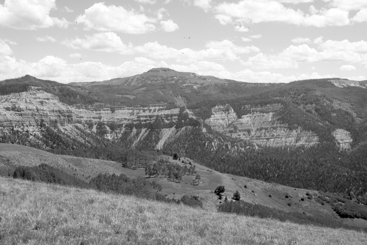
Plate 1396X. Lake Creek – Rattlesnake Creek 1966 – 2006 Viewed northeast from High Mountain to the heads of Lake and Rattlesnake Creeks. Navajo Point (10,575 ft) is on the left, Brian Head (11,307 ft) in the center, and Cedar Breaks National Monument on the right. Since 1966, ski runs have been cut below Brian Head for the ski resort of the same name. Conifers have increased, while aspen has declined.
Photo Information:
Original photograph taken in 1966; retake by Charles E. Kay on August 6, 2006 - - Photo No. 5715-32. Original photograph (Zion 7290) held by the National Park Service, Zion National Park, Springdale, UT.
Vegetative Community:
Conifer, Aspen
Location:
South West: Section 18, Range 9 West, Township 36 South; UTM 331300 E, 4170500 N; elevation 9,900 ft.
January 2018