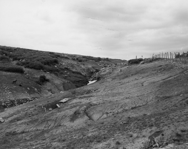
Kolob Creek
1949
2006
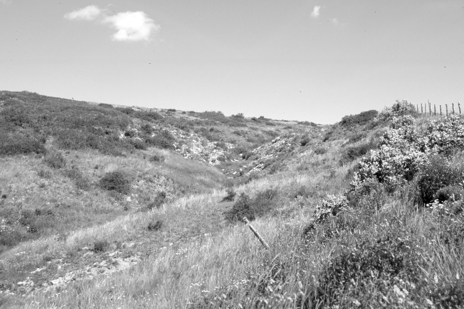
Description:
Plate 1312X. Kolob Creek 1949 – 2005 Viewed north to the very head of Kolob Creek on Cedar Mountain. The Kolob Reservoir-Cedar Mountain Road is on the right. In 1949 the area was seriously overgrazed and soil erosion was common. Today this private rangeland is still used by domestic sheep but grazing practices have changed. Plant cover has increased and soil erosion has been eliminated. The dark-colored shrubs are snowberry, while the taller shrubs on the right are elderberry. Note the sheep in the 1949 image. Plates 1312x and 1313x form a panorama.
Photo Information:
U.S. Forest Service photograph (460243) taken by Hill on June 21, 1949; retake by Charles E. Kay on July 12, 2006 - - Photo No. 5683-28A. Original photograph held by Southern Utah University Archives and Special Collections, Cedar City, UT.
Vegetative Community:
Dry Meadow
Location:
South West: Section 19, Range 10 West, Township 38 South; UTM 321200 E, 4151320 N; elevation 9,140 ft.