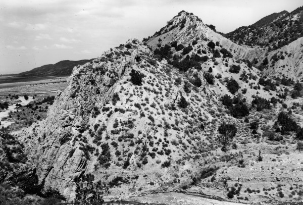
Kanarra Creek
1942
2006
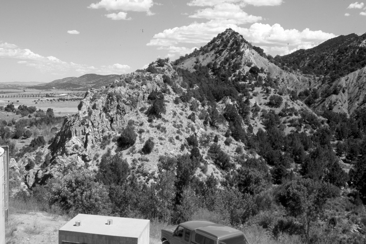
Description:
Plate 1420X. Kanarra Creek 1942 – 2006 Viewed north at the mouth of Kanarra Canyon just above the town of Kanarraville. The original photopoint has been destroyed by construction for the town’s water supply, so the retake was made from the nearest open area that could be safely reached. Woody riparian vegetation, primarily cottonwood and willows, has increased along Kanarra Creek. Pinyon and juniper have also increased, while stream erosion has declined. Note the tilted rock strata that are part of the Hurricane Cliffs.
Photo Information:
Original photograph taken by Gregory (No. 1097) in 1942; retake by Charles E. Kay on August 8, 2006 - - Photo No. 5727-13. Original photograph held by the U.S. Geological Survey Photographic Library, Denver, CO.
Vegetative Community:
Riparian, Pinyon, Juniper
Location:
South West: Section 35, Range 12 West, Township 37 South; UTM 308100 E, 4156600 N; elevation 5,700 ft.