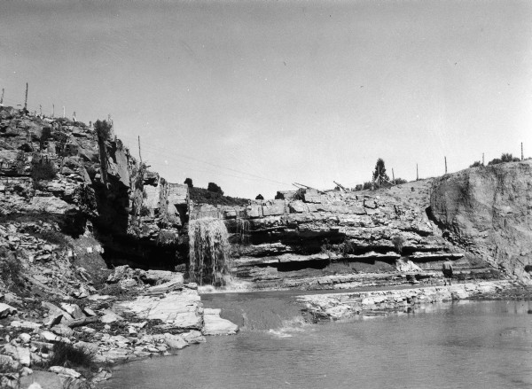
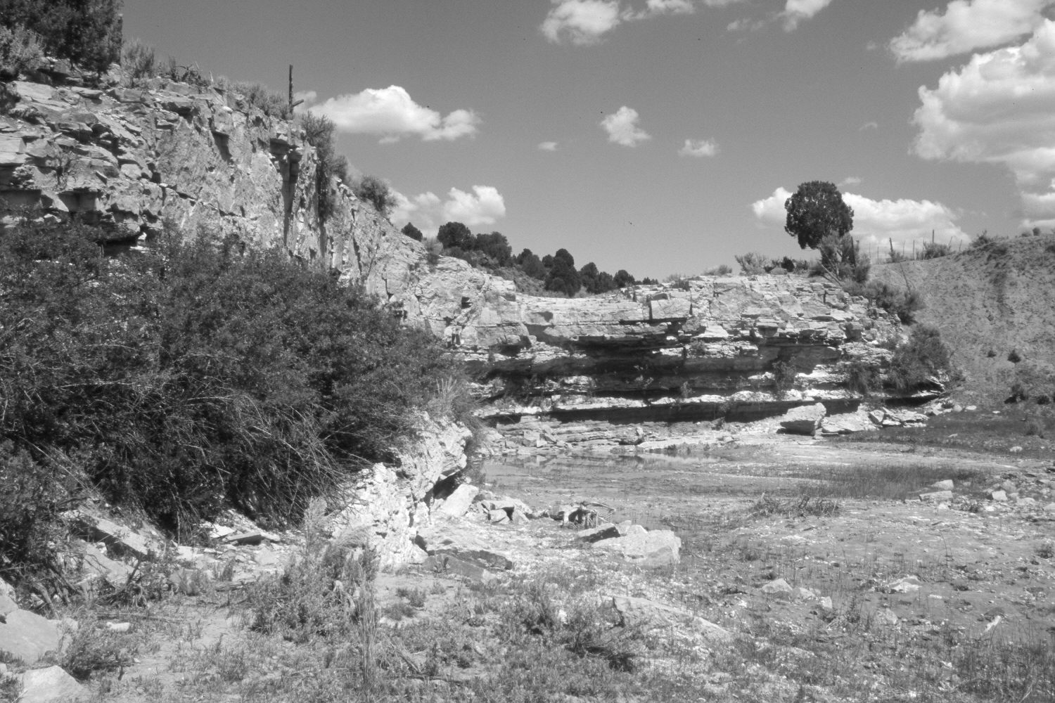
Kanab Creek Falls
1939
2006
Description:
Plate 1429X. Kanab Creek Falls 1939 – 2006 Viewed north-northeast to the falls on Kanab Creek below the Glendale-Johnson Canyon Road. Pinyon and juniper have increased in the distance. Rose has increased to the left of the falls. The foreground was heavily grazed by cattle in 2006. The mud bank on the right has eroded, as have many of the soft sandstone rocks.
Photo Information:
Original photograph taken by Gregory (No. 976) in 1939; retake by Charles E. Kay on August 30, 2006 - - Photo No. 5732-28. Original photograph held by the U.S. Geological Survey Photographic Library, Denver, CO.
Vegetative Community:
Riparian, Pinyon, Juniper
Location:
South West: Section 35, Range 6 West, Township 40 South; UTM 367700 E, 4128000 N; elevation 6,200 ft.
January 2018