Kanab Creek Dam
1890
2005
Description:
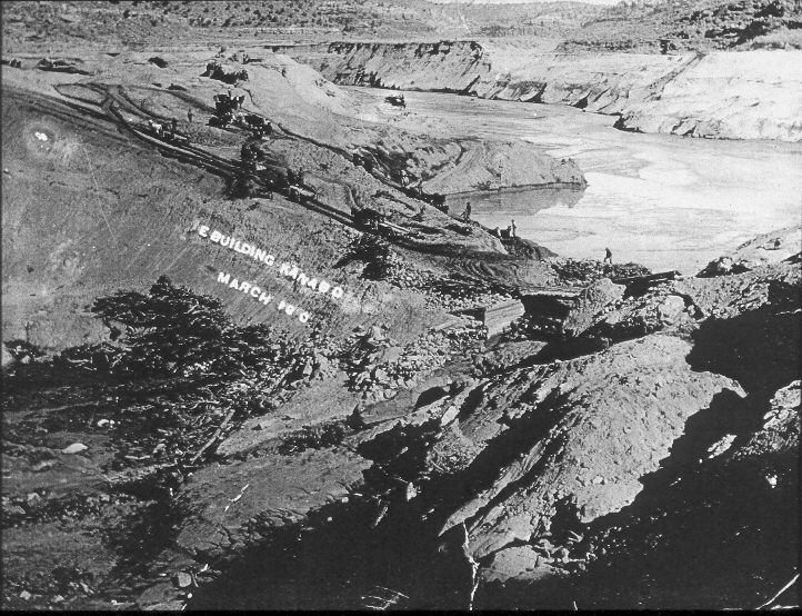
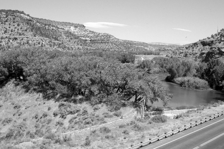
Plate 846X. Kanab Creek Dam 1890 – 2005 Viewed northwest as the dam on Kanab Creek was being rebuilt - - note the horse drawn wagons and scrappers. “Between 1871 and 1911 more than 10 different dams and associated ditches were built on Kanab Creek to supply domestic and irrigation water [to the Kanab townsite]…[but]…the dams and headgates were destroyed during successive floods” (Webb et al. 1991:15). The original photopoint was eliminated when U.S. Highway 89 was widened, so the retake was made from the first low cliff above the new roadway. The dam has not failed since the early 1920’s (Webb et al. 1991) and today cottonwoods and willows have increased most markedly. Pinyon and juniper have increased in the distance.
Photo Information:
Original photograph taken ca. 1890; retake by Charles E. Kay on June 17, 2005 - - Photo No. 5447-23. Original photograph held by the Kanab Museum, Kanab, UT.
Vegetative Community:
Riparian, Pinyon, Juniper
Location:
South West: Section 16, Range 6 West, Township 43 South; UTM 363550 E, 4103800 N; elevation 5,100 ft.