Kanab Creek Dam
1912
2005
Description:
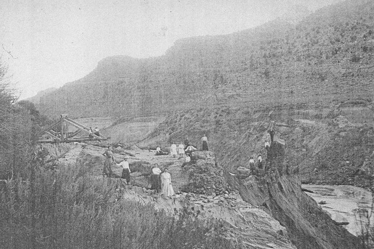
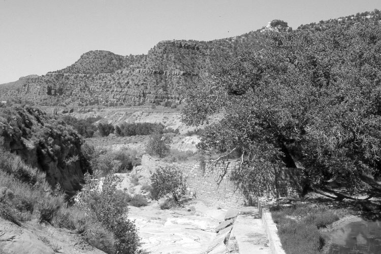
Plate 845X. Kanab Creek Dam 1912 – 2005 Viewed southwest to the dam on Kanab Creek. “Between 1871 and 1911 more than 10 different dams and associated ditches were built on Kanab Creek to supply domestic and irrigation water [to the Kanab townsite]…[but]…the dams and headgates were destroyed during successive floods” (Webb et al. 1991:15). The dam was rebuilt and has not failed since the early 1920’s (Webb et al. 1991). Cottonwoods and other woody riparian species have increased above and below the dam - - see Plates 843x, 844x, and 846x. Pinyon and juniper have increased in the distance. The structure in the foreground of the retake is the dam’s spillway. A headgate and irrigation ditch are located between the photopoint and the spillway, but are not visible in the 2005 image.
Photo Information:
Original photograph taken ca. 1912; retake by Charles E. Kay on June 17, 2005 - - Photo No. 5447-16. Original photograph held by the Kanab Museum, Kanab, UT.
Vegetative Community:
Riparian, Pinyon, Juniper
Location:
South West: Section 16, Range 6 West, Township 43 South; UTM 363500 E, 4103800 N; elevation 5,020 ft.