Kanab Creek
1931
2005
Description:
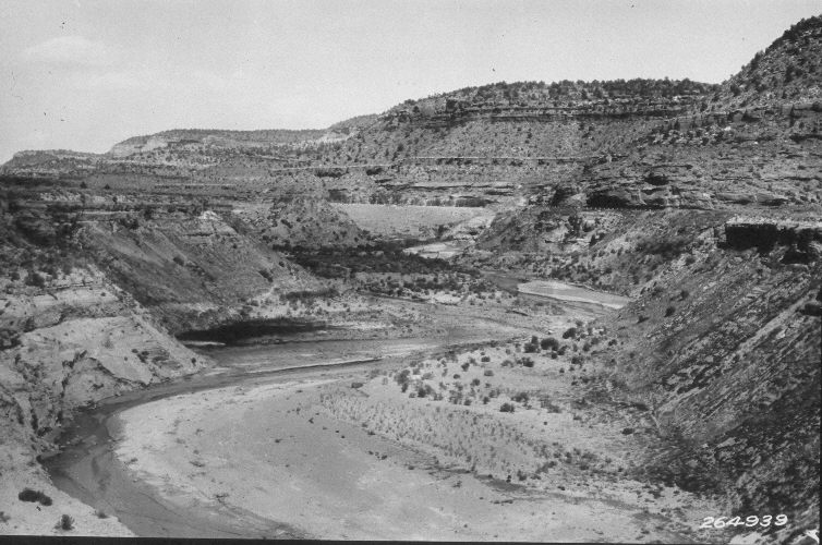
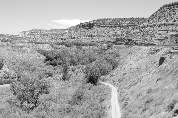
Plate 848X. Kanab Creek 1931 – 2005 Viewed northeast to the irrigation dam on Kanab Creek - - see Plates 843x to 846x. U.S. Highway 89 is on the right. An ATV trail now descends to the floodplain. Cottonwoods and willows have increased, as have Russian olive and tamarisk. The stream channel has narrowed and is more stable today than in the past. Pinyon and juniper have increased in the distance.
Photo Information:
U.S. Forest Service photograph (264939) taken by Reed W. Bailey in 1931; retake by Charles E. Kay on June 17, 2005 - - Photo No. 5447-31. Original photograph held by the Utah Historical Society, Reed W. Bailey Collection (Box 5), Salt Lake City, UT.
Vegetative Community:
Riparian, Pinyon, Juniper
Location:
South West: Section 17, Range 6 West, Township 43 South; UTM 363250 E, 4103200 N; elevation 5,000 ft.