Kanab Creek
1934
2005
Description:
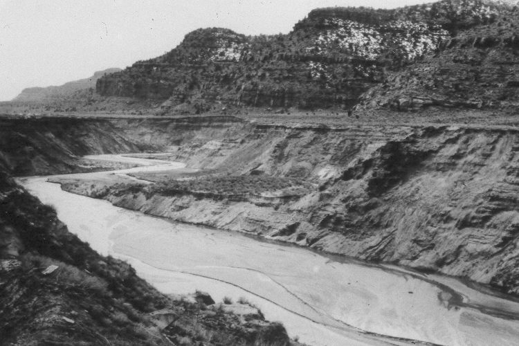
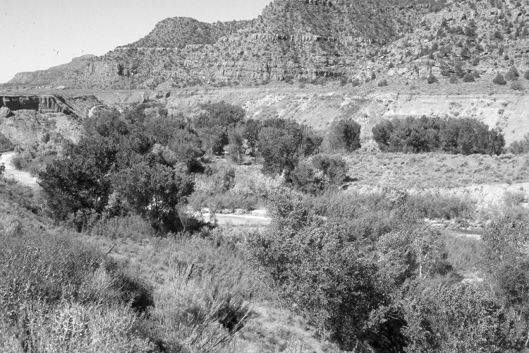
Plate 843X. Kanab Creek 1934 – 2005 Viewed southwest down Kanab Creek about 150 yards below the dam north of the townsite - - see Plates 844x, 845x, and 846x. Woody riparian vegetation has increased dramatically. Cottonwoods and willows are common, as are tamarisk and Russian olive. The stream channel has narrowed and is more stable today than it was in the past. Pinyon and juniper have increased in the distance. New homes have been built - - photo left edge. The dirt banks of an irrigation canal appear at the lower left in the first image. Cottonwoods now block the original camera station, so the retake was made from the nearest open area, which is about 100 yards further south. The old irrigation ditch has been replaced with a buried pipeline.
Photo Information:
U.S. Forest Service photograph (293830) taken by Reed W. Bailey in 1934; retake by Charles E. Kay on June 17, 2005 - - Photo No. 5447-2. Original photograph held by the Utah Historical Society, Reed W. Bailey Collection (Box 7, C-439), Salt Lake City, UT. See Webb et al. (1991:40) for a 1985 retake.
Vegetative Community:
Riparian, Pinyon, Juniper
Location:
South West: Section 16, Range 6 West, Township 43 South; UTM 363500 E, 4103700 N; elevation 5,020 ft.