Kanab Creek
1872
2005
Description:
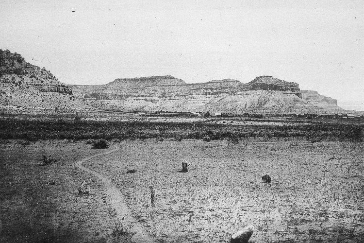
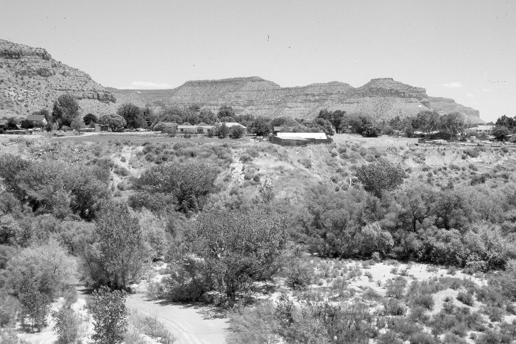
Plate 870X. Kanab Creek 1872 – 2005 Viewed east-southeast over Kanab Creek to Kanab, Utah. When Kanab was first settled in the mid-1860’s, the creek’s “flood plain was choked with native willows and other riparian vegetation; ‘Kanab’ is a Paiute word for ‘willows’. All along Kanab Creek…, the ground watertable was within 1 m of the surface most of the year. The high water table produced a meadow that was 400m wide and extended 11 km from the Vermilion Cliffs upstream to the White Cliffs and about 8 km south to where Kanab Creek spread over a broad alluvial plain” (Webb et al. 1991:15). Although the area in the foreground of Hillers’ photograph was heavily grazed by livestock in 1872, Kanab Creek had not yet begun to downcut and erode. All that changed, however, after a series of floods during the late 1800’s and early 1900’s (Webb et al. 1991). Today, Kanab Creek flows at the bottom of an arroyo 80 feet deep and over 300 feet wide. Cottonwoods and willows are again common, while the active stream channel has stabilized and is starting to agrade. The arroyo, though, remains. Similar downcutting has occurred throughout the West and is the subject of intense debate. Some claim arroyo formation was the result of widespread overgrazing during the open-range livestock era, while others contend that abnormal, high-intensity, rainfall events were largely responsible for the downcutting (Webb et al. 1991).
Photo Information:
The original camera station was destroyed when the arroyo formed, so the retake was made from the nearest safe location on the western, high, cut-bank. Original phogoraph taken by John Hillers in 1872 (Fowler 1989); retake by Charles E. Kay on June 19, 2005 - - Photo No. 5455-29. Original photograph from Dutton (1882: Plate 10). See Webb et al. (1991:4) for a 1990 retake.
Vegetative Community:
Riparian
Location:
South West: Section 20, Range 6 West, Township 43 South; UTM 361000 E, 4101750 N; elevation 4,960 ft.