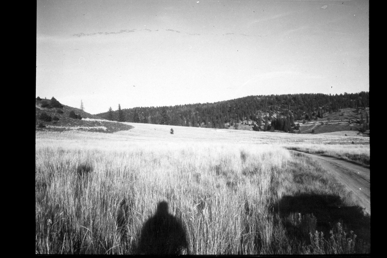
Kanab Creek
1963
2003
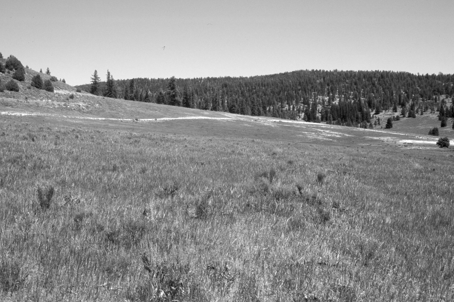
Description:
Plate 256X. Kanab Creek 1963-2003 Viewed east-northeast down Kanab Creek near its junction with the East Fork of the Sevier River on the Paunsagunt Plateau. The area in the foreground had been root-plowed, contour-trenched, and reseeded with smooth brome by the Forest Service to control erosion. The road in the original image has been abandoned and reseeded. The Forest Service has built a new road higher on the slope. The East Fork Road is also visible in the retake. The upper left hillside has been contour-trenched, as has the more distant slope just above the East Fork of the Sevier River. Spruce, juniper, and ponderosa pine have all increased. Sagebrush and rubber rabbitbrush have invaded the seeding.
Photo Information:
U.S. Forest Service photograph (unnumbered) taken by O.L. Daniels in 1963; retake by Charles E. Kay on August 5, 2003 - - Photo No. 5213-18A. Original photograph held in the range files on the Panguitch Ranger District, Dixie National Forest, Panguitch, UT.
Vegetative Community:
Dry Meadow, Conifer, Juniper, Sagebrush
Location:
South West: Section 1, Range 4½ West, Township 38 South; UTM 386050E, 4154650 N; elevation 7,970 ft.