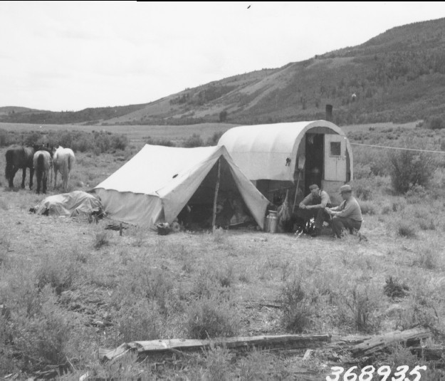
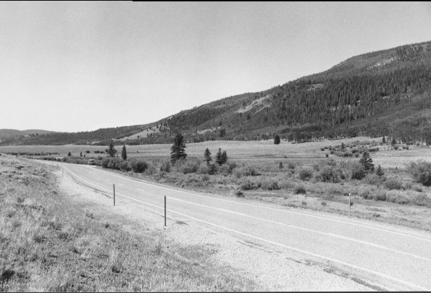
Jorgenson Flat
1938
2000
Description:
Plate 199. JORGENSON FLAT 1938-2000 The original photopoint and much of the foreground has been changed by construction of Utah Highway 25. Willows, though, are still present. Aspen has increased in height on the distant hillsides, but most stands have not regenerated due to excessive browsing. Conifers and curlleaf mountain mahogany have also increased.
Photo Information:
U.S. Forest Service photo 368935 taken in August 1938; retake by Charles E. Kay on July 28, 2000 - - Photo No. 4640-29A; Original photo (2200 Fishlake-36) held by the Forest Service Regional Office Photographic Collection housed at Weber State University, Ogden, UT.
Vegetative Community:
Wet Meadow, Aspen, Conifer, Mountain Brush
Location:
South Central: Section 27, Range 2 E, Township 25 S; UTM 441100 E, 4272900 N; elevation 8,960 ft; viewed southwest.