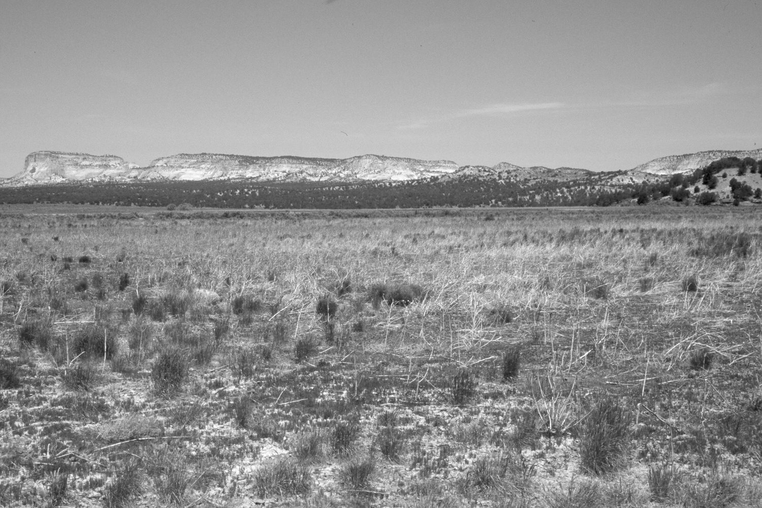
Johnson Wash
1921
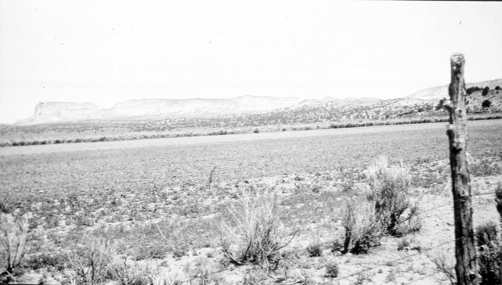
2004
Description:
Plate 469X. Johnson Wash 1921 – 2004 Viewed northwest across Johnson Wash to Dry Lake. The cultivated field in the foreground has been planted with crested wheatgrass and other non-native species. The cultivated fields have been expanded to the west. Pinyon and juniper have increased in the distance. Johnson Wash is in a 20 to 30 foot deep arroyo in the center of the cultivated field and follows the line of the taller shrubs. On the skyline are Cutler Point and the White Cliffs.
Photo Information:
Original photograph taken by R.C. Moore (No. 12) in 1921; retake by Charles E. Kay on June 6, 2004 - - Photo No. 5328-29. Original photograph held by the U.S. Geological Survey Photographic Library, Denver, CO.
Vegetative Community:
Pinyon, Juniper, Dry Meadow
Location:
South West: Section 14, Range 5 West, Township 42 South; UTM 376325 E, 4112900 N; elevation 5,480 ft.