Johnson Valley Reservoir
1962
2000
Description:
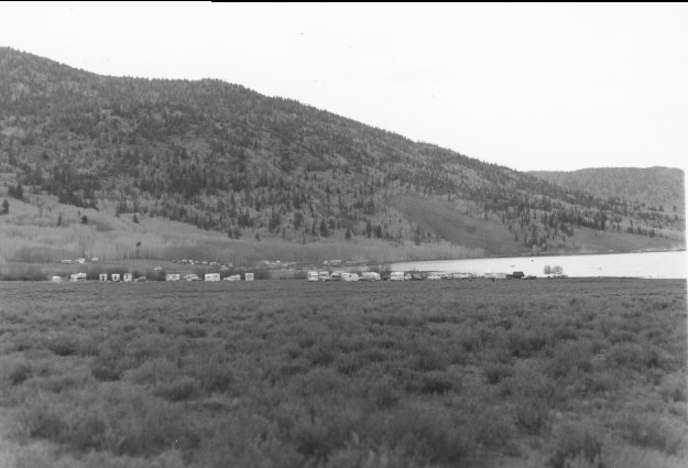
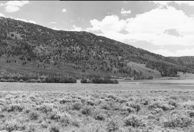
Plate 192. JOHNSON VALLEY RESERVOIR 1962-2000 Viewed northeast to where Sevenmile Creek enters Johnson Valley Reservoir. Utah Highway 25 has been realigned and paved, while random camping was eliminated after the Forest Service built several modern campgrounds in the area. The pool height has been raised by reconstruction of the existing dam (see Plates 84 and 85). Aspen is leafless in the original as that photo was taken late in the fall. Most aspen stands have now been heavily invaded by conifers and have not regenerated in recent years. Sagebrush appears unchanged.
Photo Information:
U.S. Forest Service photo (unnumbered) taken in 1962; retake by Charles E. Kay on July 27, 2000 - - Photo No. 4637-33;Original photo held by the Loa Ranger District, Fishlake National Forest, Loa, UT.
Vegetative Community:
Riparian, Aspen, Conifer, Sagebrush
Location:
South Central: Section 24, Range 2 E, Township 25 S; UTM 443500 E, 4274500 N; elevation 8,850 ft.