John L. Swale
1911
2003
Description:
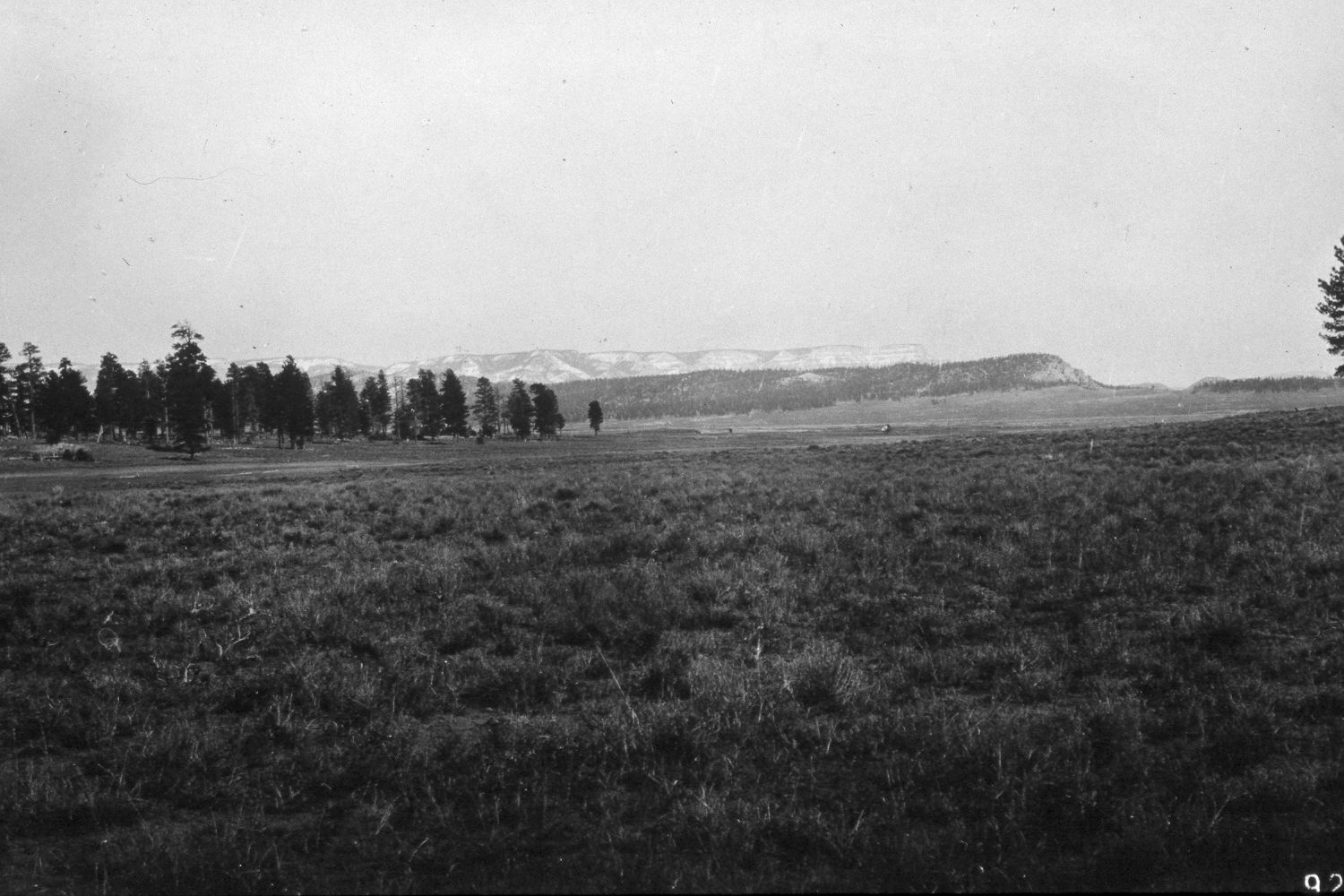
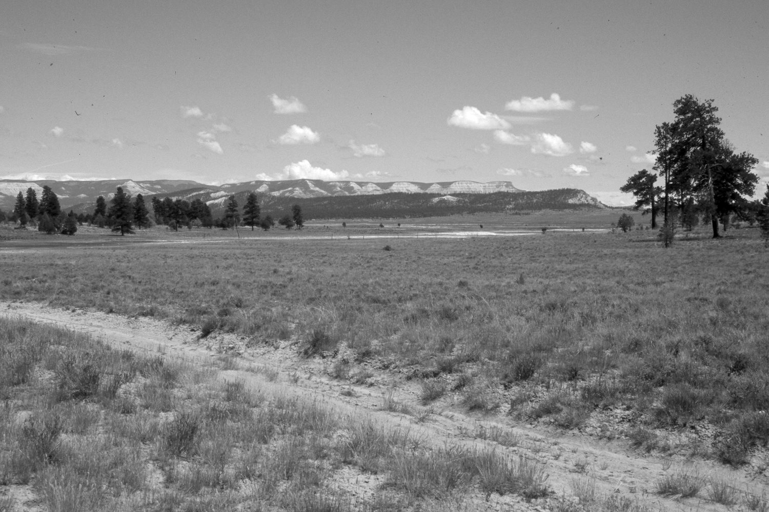
Plate 211X. John L Swale 1911 - 2003 Viewed east down John L swale and across Johns Valley to Henderson Point (8,273 ft.) with Powell Point (10,188 ft.) and Table Cliff Plateau on the skyline. Note how few, young ponderosa pine there were in 1911, as frequent but low-intensity fires once limited pine regeneration, and how that has changed today. All the larger trees in the original image have been logged, but the pine forest still is as thick as ever. Ponderosa pine, as well as pinyon and juniper have also increased on the more distant hillsides. Sagebrush has declined in the foreground, as that area was root-plowed and reseeded with crested wheatgrass during the 1950’s. The area was not grazed by cattle in 2003. Pronghorn antelope, however, were using the area. Both patches of timber in the mid-ground were recently prescribe-burned by the Forest Service, but pine mortality was minimal.
Photo Information:
U.S. Forest Service photograph (92827) taken by L. Crowell on April 16, 1911; retake by Charles E. Kay on August 2, 2003 - - Photo No. 5195-22. Original photograph held by Southern Utah University Archives and Special Collections, Cedar City, UT.
Vegetative Community:
Conifer, Pinyon, Juniper, Sagebrush
Location:
South West: Section 30, Range 3 West, Township 35 South; UTM 397500E, 4176200N; elevation 7,620 ft.