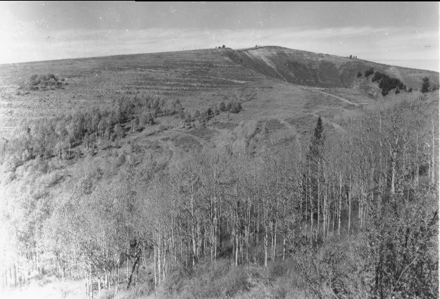
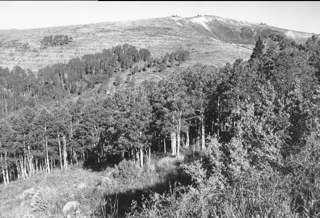
Jacks Peak
1961
1999
Description:
Plate 104. JACKS PEAK: 1961 - 1999 The view is over the head of Broad Canyon to Jacks Peak. The area had been contour trenched and seeded to prevent soil erosion shortly before the 1961 photo was taken. Although the aspen (Populus tremuloides) is taller in 1999 than in the 1961 photo, it has not regenerated. Conifers below Jacks Peak (1961 photo right-upper center) died sometime before 1999.
Photo Information:
1961 photo taken in the fall by the U.S. Forest Service; 1999 photo is Kay #4490-24A, taken on Sept. 5. Forest Service photo [2500B-Erosion control] held by the Fillmore Ranger District, Fishlake National Forest, Fillmore, UT
Vegetative Community:
Aspen, Conifer
Location:
South Central: North Fork of Chalk Creek, Fishlake National Forest, Fillmore Ranger District, T21S, R2.5W, Sect. 15, UTM 4315350 N, 402350 E; elevation 9,600 ft., viewed to northwest.