Horse Valley
1956
2007
Description:
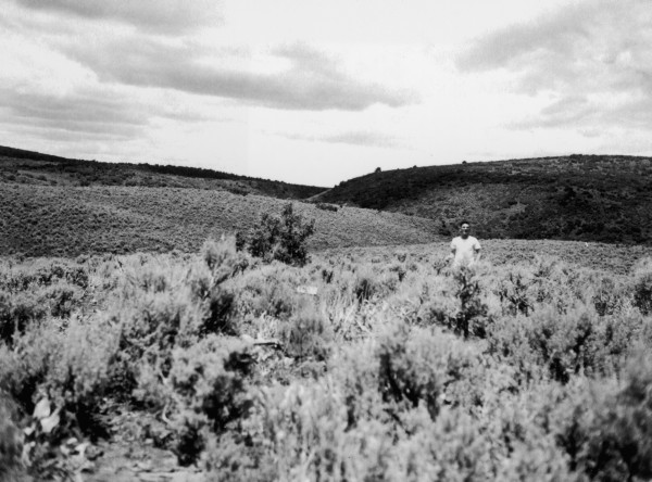
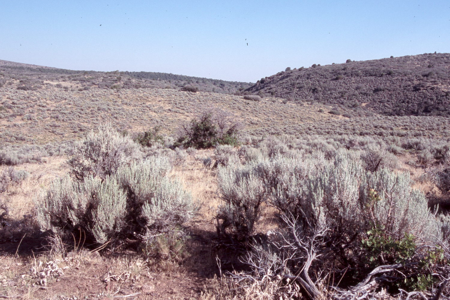
Plate 1492X. Horse Valley 1956 – 2007 In 1956, the Forest Service established three Parker Three-Step Transects in Horse Valley near the head of Spring Creek. Horse Valley lies between Grassy Flat on the southeast and Mountain Meadows on the west in the Pine Valley Mountains. Since the transects were first measured, cattle AUM’s have been cut by half and a three-pasture, deferred-rotation grazing system instituted. Plate 1492x is viewed northwest at the start of the second transect. Sagebrush has declined, while cheatgrass, oakbrush, Utah serviceberry, pinyon, and juniper have all increased. The area was actively being grazed by cattle when the site was revisited.
Photo Information:
Forest Service photograph (unnumbered) taken by Cook on June 15, 1956; retake by Charles E. Kay on August 22, 2007 - - Photo No. 5830-31A. Original photographs, negatives, and narrative reports held in the range files on the St. George Ranger District, Dixie National Forest, St. George, UT.
Vegetative Community:
Sagebrush, Mountain Brush, Pinyon, Juniper
Location:
South West: Section 17, Range 15 West, Township 38 South; UTM 273756 E, 4151017 N; elevation 6,778 ft.