Horse Creek Top Escalante Mountain
1936
2005
Description:
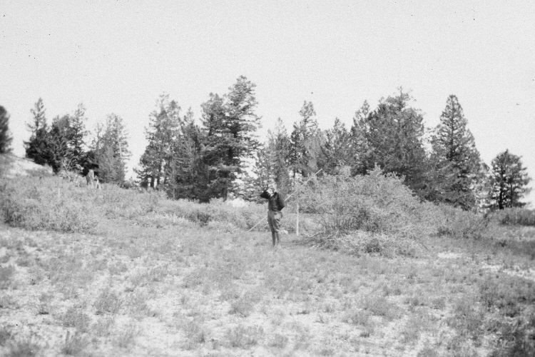
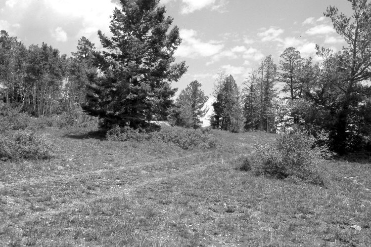
Plate 901X. Horse Creek Top Escalante Mountain 1936 – 2005 Viewed northeast from Course A back to the starting point on the old Widstoe-Escalante Summit Snow Survey on Horse Creek Top. In 1936, a series of snow courses were developed throughout southern Utah by what is today the Natural Resources Conservation Service (NRCS). When they were first established, photographs were taken at each snow survey site. Although the snow course at Widstoe-Escalante Summit is no longer used by NRCS, the photos remain. The steel post seen in the distance marks the start of the snow course - - see Plate 899x. A limber pine has grown-up on the right, while a Douglas fir has established on the left.
Photo Information:
Original photograph (NRCS – 192) taken on September 10, 1936; retake by Charles E. Kay on June 23, 2005 - - Photo No. 5465-27A. Original photograph held by the Snow Survey Supervisor, Natural Resources Conservation Service, Salt Lake City, UT.
Vegetative Community:
Conifer
Location:
South West: Section 22, Range 1 West, Township 39 South; UTM 422650 E, 4187400 N; elevation 9,640 ft.