Horse Creek Top Escalante Mountain
1936
2005
Description:
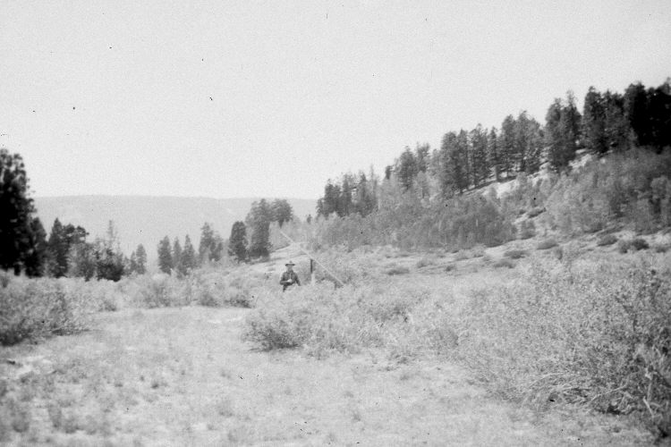
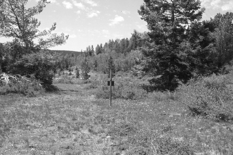
Plate 899X. Horse Creek Top Escalante Mountain 1936 – 2005 Viewed southwest to the old Widstoe-Escalante summit snow survey course on Horse Creek Top. In 1936, a series of snow courses were developed throughout southern Utah by what is today the Natural Resources Conservation Service (NRCS). When they were first established, photographs were taken at each snow survey site. Although the snow course at Widstoe-Escalante Summit is no longer used by NRCS, the photos remain. The steel post marks the start of the former snow course. A limber pine has grown-up on the left and a Douglas fir on the right. The tall shrubs are currants, while the shorter shrubs are snowberry. Aspen has increased in height and there was some regeneration 30 years ago when mule deer numbers were low (Kay and Bartos 2000). Douglas fir and limber pine have increased despite the fact that many of the larger trees have been logged. The area is grazed by cattle, elk, and deer. See Plates 900x and 901x for additional views of the old snow course.
Photo Information:
Original photograph (NRCS – 191) taken on September 10, 1936; retake by Charles E. Kay on June 23, 2005 - - Photo No. 5465-15A. Original photograph held by the Snow Survey Supervisor, Natural Resources Conservation Service, Salt Lake City, UT.
Vegetative Community:
Conifer, Mountain Brush, Aspen
Location:
South West: Section 22, Range 1 West, Township 39 South; UTM 422650 E, 4187450 N; elevation 9,640 ft.