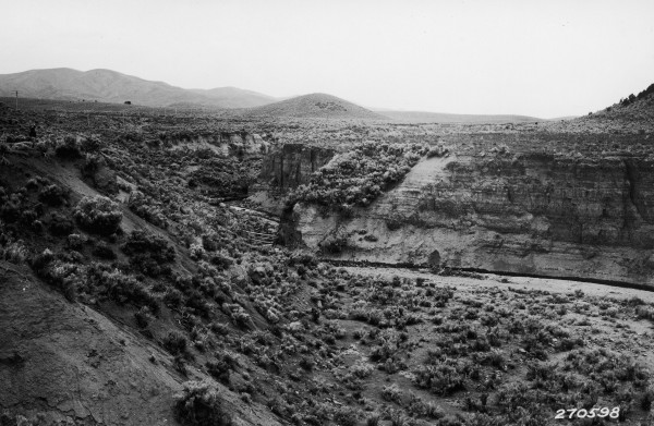
Holt Canyon
1932
2007
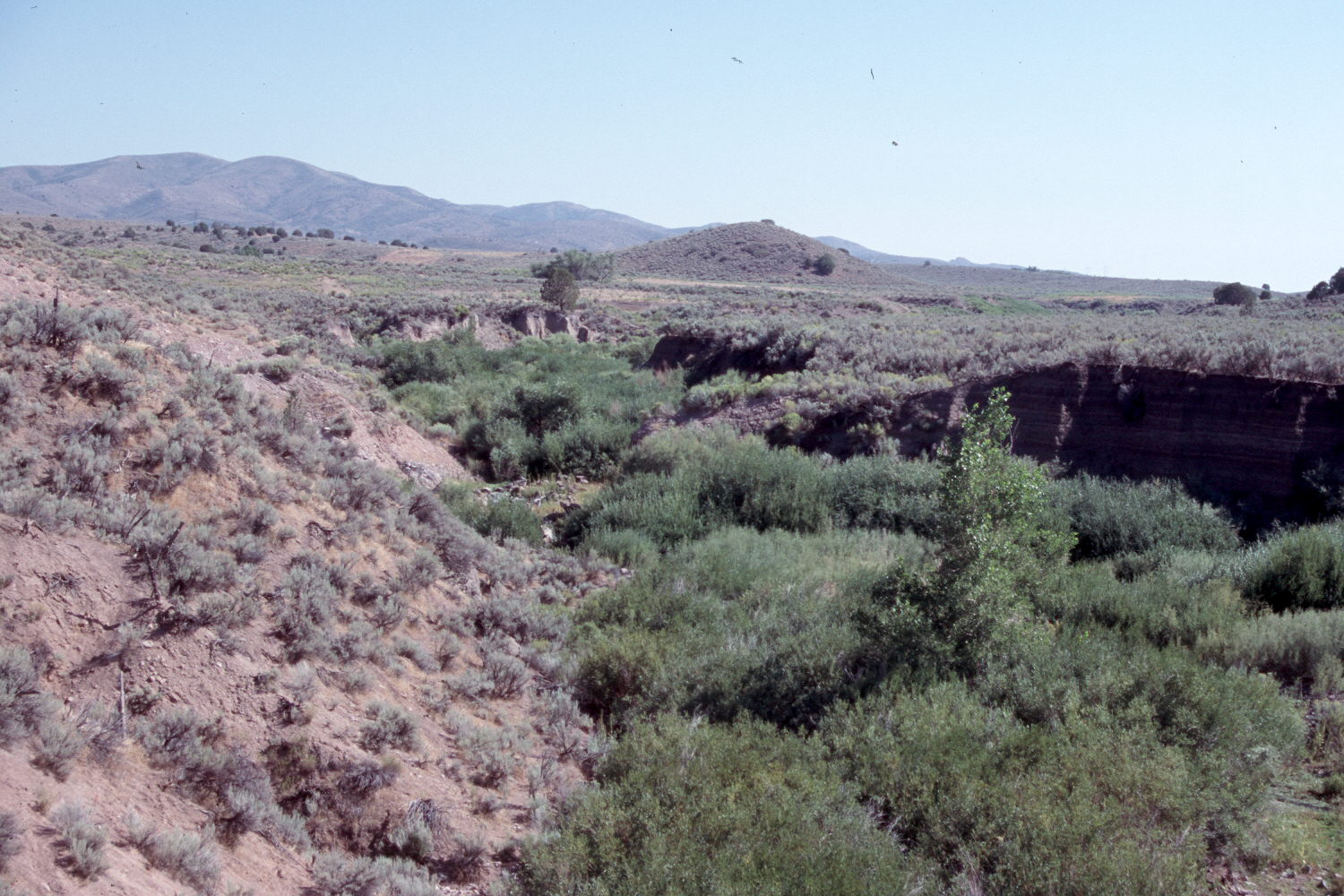
Description:
Plate 1490X. Holt Canyon 1932 – 2007 Viewed south up Holt Canyon to Mountain Meadows. The abandoned town of Hamblin is just off the photo to the left. The low hill in the center of the image is the photopoint for Plate 1489x. This is where the Old Spanish Trail entered Mountain Meadows on the way to California. During the early 1800’s, this valley was a series of wet meadows and dry grasslands. Sagebrush was absent and pinyon-juniper was confined to the highest peaks (Cottam 1929, Cottam and Stewart 1940). The area was settled by Europeans during the 1860’s after which cattle and sheep were permitted to overgraze the range. Prior to that time there were no arroyos in the valley. Floods during 1884 overwhelmed the devastated rangelands and cut most of the gullies seen in the valley today. As livestock destroyed the original grass cover, sagebrush and pinyon-juniper increased (Cottam and Stewart 1940). All this took place before the 1933 photograph was made. Today the main arroyo has started to heal, as willows and cottonwoods have increased. Pinyon and juniper have continued their increase.
Photo Information:
Forest Service photograph (270598) taken by Reed W. Bailey in 1932; retake by Charles E. Kay on August 21, 2007 - - Photo No. 5830-24A. Original photograph held by the Utah Historical Society, Reed W. Bailey Collection (Box 5), Salt Lake City, UT.
Vegetative Community:
Pinyon, Juniper, Sagebrush
Location:
South West: Section 23, Range16 West, Township 37 South; UTM 269238 E, 4158793 N; elevation 5,715 ft.