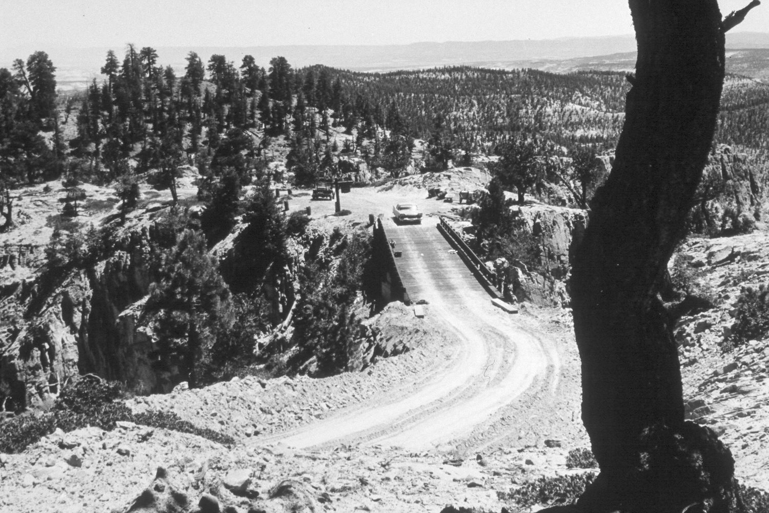
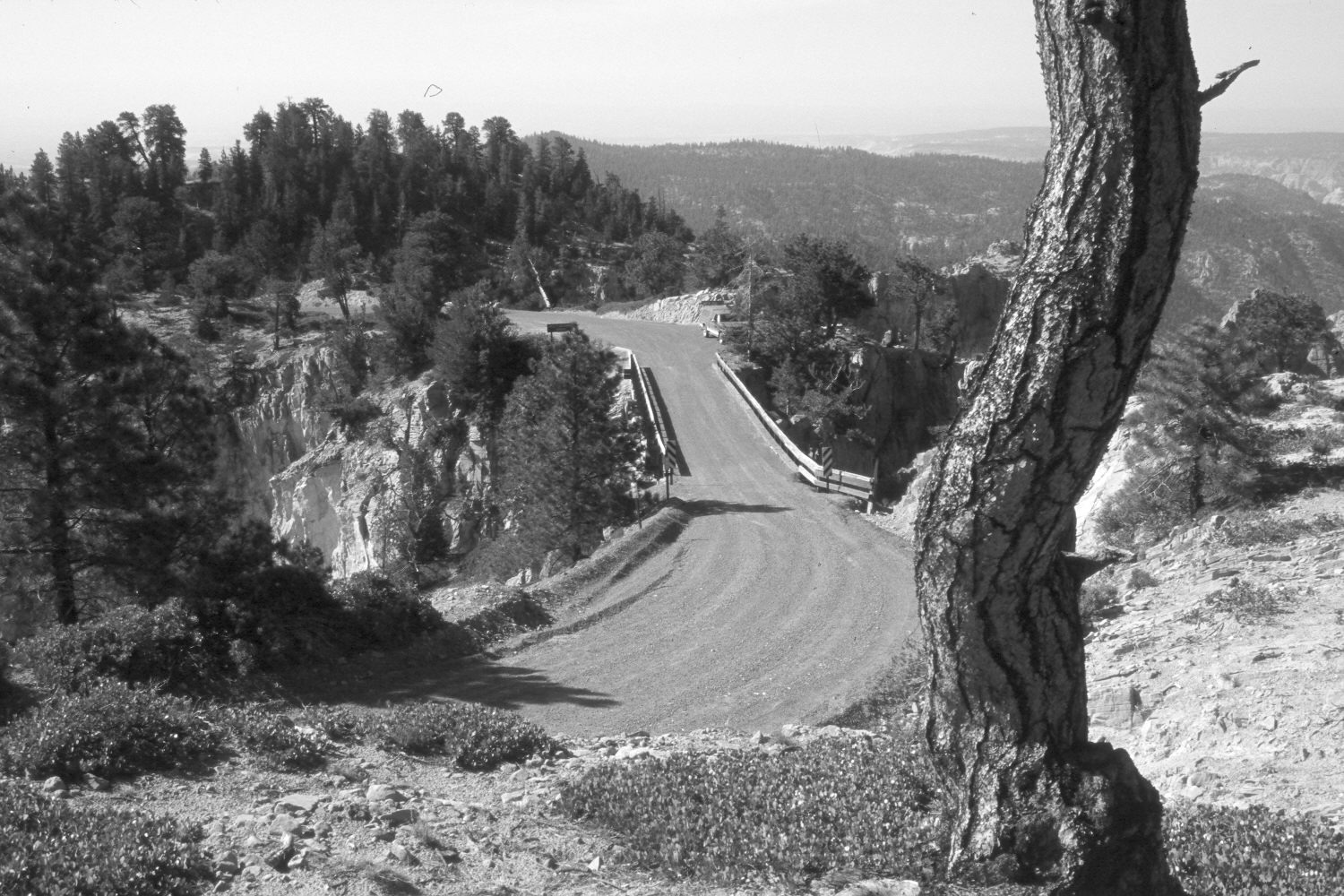
Hell'S Backbone
ca. 1960
2002
Description:
Plate 61X. Hell’s Backbone ca. 1960-2002 Viewed south at the bridge on Hell’s Backbone. Conifers, primarily ponderosa pine, have increased in height and numbers, especially on the hillside behind the bridge.
Photo Information:
U.S. Forest Service photograph (unnumbered) taken ca. 1960; retake by Charles E. Kay on July 11, 2002 - - Photo No. 4975-25. Original photograph held by Southern Utah University Archives and Special Collections, Cedar City, UT.
Vegetative Community:
Conifer
Location:
South West: Section 5, Range 3 East, Township 33 South; UTM 447500E, 4202500N; elevation 8,860 ft.
January 2018